GEOSCIENCE BOOKS
Phillip Huber, Bookseller/Geologist
PO Box 1036, Faribault, Minnesota 55021
USA
SOUTH DAKOTA FEATURED ITEMS
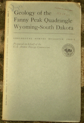
Brobst D. A. and Epstein J. B. 1963 GEOLOGY OF THE FANNY PEAK QUADRANGLE WYOMING-SOUTH DAKOTA USGS Bull. #1063-I wraps ex-lib else light wear, vg, 55 pp., 2 plts 9 figs. including large folding colored pocket map. Price: $20.00 (stock#USGSB1063I)

BROWN COUNTY. Watkins W. I. and Larson G. A. 1925 SOIL SURVEY OF BROWN COUNTY SOUTH DAKOTA 8vo, wraps, ex-lib else light wear, vg, 32 pp., 2 plts, large folding colored map measuring 40 x 52".
Price: $30.00 (stock#SDsoilsBrown)

Calvert W. B. et al. 1914 GEOLOGY OF THE STANDING ROCK AND CHEYENNE RIVER INDIAN RESERVATIONS NORTH AND SOUTH DAKOTA USGS Bulletin #575 wraps and contents with small stamp, small dog earred corner to lower outer corner of wrap and title and contents pages but rest of volume unaffected. Sought after for the large folding pocket map, which is in very good condition. With 49 pp., 8 plts, 1 fig., large fold out map in the rear pocket with another fold out bound into text. Price: $20.00 (stock#USGSB575)

Cuppels N. P. 1962 GEOLOGIC ENVIRONMENT OF AN OXIDIZED URANIUM DEPOSIT IN THE BLACK HILLS SOUTH DAKOTA USGS Bull. #1063-C 8vo, wps, ex-lib else some external wear, contents vg, 23 pp., 4 plts 5 figs. Price: $15.00 (stock#USGSB1063C)
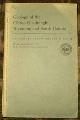
Cuppels N. P. 1963 GEOLOGY OF THE CLIFTON QUADRANGLE WYOMING AND SOUTH DAKOTA USGS Bull. #1063-G wraps, ex-lib else light wear, vg, 52 pp., 2 plates, 9 figs. Nice pocket map.
Price: $20.00 (stock#USGSB1063H)

Darton N. H. 1909 BELLE FOURCHE FOLIO SOUTH DAKOTA USGS Atlas Folio #164 wps with short tear, tape repair to short marginal tear on topo sheet else light wear, contents vg, 9 pp. Descriptive Text, Topographic Map, Areal Geology Map, Structure Geology Map, Artesian Water Resources Map. Price: $35.00 (stock#AF164)
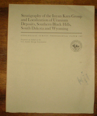
Gott G. B. et al. 1974 STRATIGRAPHY OF THE INYAN KARA GROUP AND LOCALIZATION OF URANIUM DEPOSITS SOUTHERN BLACK HILS, SOUTH DAKOTA AND WYOMING USGS Prof. Paper #763 wps with stamp light wear vg, 57 pp. 4 plts, 23 figs. Price: $20.00 (stock#PP763)
HYDE COUNTY. Machlis J. A. and Williams B. H. 1925 SOIL SURVEY OF HYDE COUNTY SOUTH DAKOTA 8vo, wraps, ex-lib else light wear, vg, 20 pp., large folding colored map measuring 22 x 52".
Price: $30.00 (stock#SDsoilsHyde)

MOODY COUNTY. Watkins W. I. and Larson G. A. 1926 SOIL SURVEY OF MOODY COUNTY SOUTH DAKOTA 8vo, wraps, ex-lib else light wear, vg, 27 pp., large folding colored map measuring 25.5 x 27.5".
Price: $30.00 (stock#SDsoilsMoody)

Redden J. A. 1959 BERYL DEPOSITS OF THE BEECHER NO. 3-BLACK DIAMOND PEGMATITE CUSTER COUNTY SOUTH DAKOTA wraps, light wear, ex-lib else vg, 22 pp., 2 plates, 1 fig. Price: $15.00 (stock#USGSB1072I)
Redden J. A. 1968 GEOLOGY OF THE BERNE QUADRANGLE BLACK HILLS SOUTH DAKOTA USGS Prof. Paper #297-F wraps with some wear, ex-lib., contents vg with 56 pp., plts, figs. Price: $20.00 (stock#PP297F)
Sheriden D. M. 1955 GEOLOGY OF THE HIGH CLIMB PEGMATITE CUSTER COUNTY SOUTH DAKOTA USGS Bull. #1015-C 8vo, wps, ex-lib, some wear, contents vg, 40 pp., 1 plt, 4 figs. Price: $15.00 (stock#USGSB1015C)
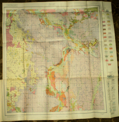
Sims P. K. et al. 1991 PRECAMBRIAN BASEMENT MAP OF THE TRANS-HUDSON OROGEN AND ADJACENT TERRANES NORTHERN GREAT PLAINS USGS Map I-2214 large folding map in printed sleeve.
Price: $10.00 (stock#MapI2214)
Smith W. C. and Page L. R. 1941 TIN-BEARING PEGMATITES OF THE TINTON DISTRICT LAWRENCE COUNTY SOUTH DAKOTA USGS Bull. 922-T title wps, small stamp, crease to lower outer corner else light wear, vg, 36 pp., 5 plts, 2 figs. Price: $15.00 (stock#USGSB922Tr)
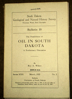
Wilson R. A. 1922 THE POSSIBILITIES OF OIL IN SOUTH DAKOTA SD Geol. Surv. Bull. #10 wps with small name stamp else light wear, vg, 97pp., 3 plts, figs and folding map at rear. Price: $25.00 (stock#SDGSB10)

Winchester D. E. et al. 1916 THE LIGNITE FIELD OF NORTHWESTERN SOUTH DAKOTA USGS Bulletin #627 wraps with multiple signatures, stamp to wraps and contents ex-lib. copy but overall light+ wear to contents which are gppd and include 169 pp., 11 plts, 3 figs. On the Lance and Fort Union Formations (K-T Boundary units) in much of South Dakota. Price: $20.00 (stock#USGSB627)
OTHER SOUTH DAKOTA GEOLOGY PUBLICATIONS
U. S. BUREAU OF MINES PUBLICATIONS
CIRCULARS
#7084 Guiteras J. R. 1939 MINING AND MILLING METHODS AND COSTS AT THE BLACK HILLS TIN COMPANY, TINTON, SOUTH DAKOTA wps, light wear, vg, 16 pp. figs. Price: $20.00 (stock#USBMC7084)
REPORTS OF INVESTIGATIONS
#4375 Pesonen P. E. et al. 1949 MISSOURI VALLEY MANGANESE DEPOSITS, SOUTH GENERAL INVESTIGATIONS, STRATIGRAPHIC STUDIES AND TONNAGE AND GRADE ESTIMATES 4to, title wps with stamp, some wear, contents vg, 91 pp., numerous figs. Price: $15.00 (stock#USBMRI4375)
#4396 Gries J. P. 1949 SAMPLING OF HELEN BERYL PEGMATITE CUSTER COUNTY SOUTH DAKOTA U. S. Bur. Mines Rpt. Invest. #4396 wps, ex-lib vg. Price: $15.00 (stock#USBMRI4396)
U. S. GEOLOGICAL SURVEY PUBLICATIONS
ATLAS FOLIOS
#99 MITCHELL SOUTH DAKOTA 1903 wps with minor marginal chips else vg, clean copy with 7 pp. Descriptive Text; Areal Geology Map; Artesian Water Resources Map. Price: $20.00 (stock#AF99)
#113 HURON SOUTH DAKOTA 1904 ex-lib else vg copy, contents fine with 6 pp. Descriptive Text; Topographic Map; Areal Geology Map; Artesian Water Resources Map. Price: $20.00 (stock#AF113)
#114 DE SMET SOUTH DAKOTA 1904 ex-lib else vg copy, contents fine with 6pp. Descriptive Text; Topographic Map; Areal Geology Map; Artesian Water Resources Map. Price: $20.00 (stock#AF114)
#156 ELK POINT SOUTH DAKOTA NEBRASKA IOWA 1912 wps w/ small chips, ex-lib., contents vg, clean, 8 pp. Descriptive Text; Topographic Map; Areal Geology Map; Artesian Water Resources Map.
Price: $30.00 (stock#AF156)
#164 BELLE FOURCHE SOUTH DAKOTA 1909 wrps with minor chips, light wear, vg copy with 9 pp. Descriptive Text; Topographic Map; Areal Geology Map; Structural Geology Map; Artesian Water Resources Map.
Price: $35.00 (stock#AF164)
#165 ABERDEEN-REDFIELD SOUTH DAKOTA 1909 ex-lib else vg copy, contents clean with 13 pp. Descriptive Text; 4 Topographic Maps; 4 Areal Geology Maps; 4 Artesian Water Resources Maps. Price: $35.00 (stock#AF165)
BULLETINS
#499 COAL NEAR THE BLACK HILLS WYOMING – SOUTH DAKOTA By Stone, R. W. 1912 USGS Bull 499 8vo, in archival wraps else very good, clean with 66 pp., 7 pls, 8 figs. Price: $20.00 (stock#USGSB499)
#1009-I Gill J. R. and Moore G. W. 1953 CARNOTITE BEARING SANDSTONE IN CEDAR CANYON, SLIM BUTTES HARDING COUNTY SOUTH DAKOTA 8vo, wps with crease else light lib., 16 pp., 2 plts, 3 figs.
Price: $10.00 (stock#USGSB1009I)
#1009-G Bell H. and Bales W. E. 1955 URANIUM DEPOSITS IN FALL RIVER COUNTY SOUTH DAKOTA wps light wear, ex-lib else vg, 21 pp., 5 plts, 6 figs. Price: $20.00 (stock#USGSB1009G)
#1015-C Sheriden D. M. 1955 GEOLOGY OF THE HIGH CLIMB PEGMATITE CUSTER COUNTY SOUTH DAKOTA 8vo, wps with stamp, some wear, contents good, 40 pp., 1 plt, 4 figs. Price: $15.00 (stock#USGSB1015C)
#1023 Knetchel M. M. and Patterson S. H. 1956 BENTONITE DEPOSITS IN MARINE CRETACEOUS FORMATIONS OF THE HARDIN DISTRICT MONTANA AND WYOMING USGS Bull. #1023 wps, ex-lib, some exterior wear contents vg, 116 pp., 2 plts, 12 figs. Price: $20.00 (stock#USGSB1023)
#1332-A Bayley R. W. A PRELIMINARY REPORT ON THE GEOLOGY AND GOLD DEPOSITS OF THE ROCHFORD DISTRICT BLACK HILLS SOUTH DAKOTA 8vo, wps with small spot else vg copy, 24 pp., 1 plt, 4 figs.
Price: $25.00 (stock#USGSB1332A)
#1063-A Braddock W. A. 1957 STRATIGRAPHIC AND STRUCTURAL CONTROLS OF URANIUM DEPOSITS ON LONG MOUNTAIN SOUTH DAKOTA wps light wear vg, 11 pp., 4 plts, 4 figs. Price: $15.00 (stock#USGSB1063A)
#1063-C Cuppels N. P. 1962 GEOLOGIC ENVIRONMENT OF AN OXIDIZED URANIUM DEPOSIT IN THE BLACK HILLS SOUTH DAKOTA 8vo, wps, ex-lib else vg, 23 pp., 4 plts 5 figs. Price: $15.00 (stock#USGSB1063C)
#1063-F Schnabel R. W. 1963 GEOLOGY OF THE BURDOCK QUADRANGLE FALL RIVER AND CUSTER COUNTIES SOUTH DAKOTA 8vo, wraps, light wear, vg, 26 pp., 3 plts and 4 figs and located in the Black Hills region.
Price: $20.00 (stock#USGSB1063F)
#1063-J Ryan J. D. GEOLOGY OF THE EDGEMONT QUADRANGLE FALL RIVER COUNTY SOUTH DAKOTA wps light wear, vg. A classic Black Hills region geology Report with a very nice large, folding colored bedrock map. Contains 48 pp., 1 plt, 10 figs. Price: $20.00 (stock#USGSB1063J)
#1063-K GEOLOGY OF THE HOT SPRINGS QUADRANGLE FALL RIVER AND CUSTER COUNTIES SOUTH DAKOTA USGS BULL. 1063-K 8vo wraps, ex-library else very good with 16 pp., 1 plate, 1 figure on the geology of the southeast flank of the Black Hills. Price: $20.00 (stock#USGSB1063K)
#1063-L GEOLOGY OF THE CASCADE SPRINGS QUADRANGLE FALL RIVER COUNTY SOUTH DAKOTA USGS BULL. 1063-L 8vo wraps, ex-library else vg good, clean with 62 pp., 3 plts, 6 figs on the geology of the south end of the Black Hills. Price: $20.00 (stock#USGSB1063L)
#1063-M Bell H. III and Post E. V. 1971 GEOLOGY OF THE FLINT HILL QUADRANGLE FALL RIVER COUNTY SOUTH DAKOTA 8vo, wps, light wear, vg, 81 pp., 2 plts, 16 figs. With much on the Jurassic-Cretaceous Lakota Group.
Price: $20.00 (stock#USGSB1063M)
#1082-M Knetchel M. M. and Patterson S. H. 1962 BENTONITE DEPOSITS OF THE NORTHERN BLACK HILLS DISTRICT WYOMING MONTANA AND SOUTH DAKOTA 8vo, wps, 138 pp., 2 plts, 19 figs. Covers mostly Cretaceous formations. Price: $20.00 (stock#USGSB1082M)
#1081-B Waage K. M. STRATIGRAPHY OF THE INYAN KARA GROUP IN THE BLACK HILLS 8vo, wps, light wear, vg, 90 pp., 1 plt, 5 figs. A classic Black Hills geology report. Price: $15.00 (stock#USGSB1081B)
#1162-E Redden J. A. 1963 DIAMOND DRILLING EXPLORATION OF THE BEECHER NO. 3 – BLACK DIAMOND PEGMATITE CUSTER COUNTY SOUTH DAKOTA wps light wear, ex-lib vg, 11 pp., 1 fig.
Price: $15.00 (stock#USGSB1162E)
#1271-B Rattee J. C. and Wayland R. G. 1969 GEOLOGY OF THE HILL CITY QUADRANGLE PENNINGTON COUNTY SOUTH DAKOTA – A PRELIMINARY REPORT wps light wear, ex-lib else vg, 14 pp., 1 plt, 1 fig including the large folding colored map in rear pocket. With brief summary of gold mining in the study area.
Price: $20.00 (stock#USGSB1271B)
PROFESSIONAL PAPERS
#297-A GEOLOGY AND BERYL DEPOSITS OF THE PEERLESS PEGMATITE, PENNINGTON COUNTY, SOUTH DAKOTA By Sheridan, D. M. 1957 4to, wraps, light wear, very good with 46 pp., 7 plts. Price: $20.00 (stock#PP297A)
#297-B Norton J. J. et al. GEOLOGY OF THE HUGO PEGMATITE, KEYSTONE SOUTH DAKOTA USGS PP-297-B 4to, wraps, light wear, very good with 78 pp., 5 plts covering the famous Hugo Pegmatite, located near Keystone.
Price: $20.00 (stock#PP297B)
#297-C Staatz M. H. et al. EXPLORATION FOR BERYLLIUM AT THE HELEN BERYL ELKORN, AND TIN MOUNTAIN PEGMATITES, CUSTER COUNTY, SOUTH DAKOTA USGS PP-297-C 4to, wraps, light wear, very good with 66 pp., 8 plts. Price: $20.00 (stock#PP297C)
#297-F GEOLOGY OF THE BERNE QUADRANGLE BLACK HILLS SOUTH DAKOTA wraps with some wear, overall vg, 66 pp., 3 pls., 23 figs. With good info. on minerals pegmatites and gold mines of the study area.
Price: $20.00 (stock#PP297F)
WATER SUPPLY PAPERS
Slichter C. S. and Wolff H. C. 1906 THE UNDERFLOW OF THE SOUTH PLATTE VALLEY USGS Water Supply Paper #184 no wps, tape along spine, short tear to title page margin, contents vg with 42 pp., figs.
Price: $15.00 (stock#WSP184)
U. S. GEOLOGICAL SURVEY MAPS
HA (HYDROLOGIC ATLAS SERIES) MAPS
Ellis M. J. and Adolphson, D. G. 1965 HYDROGEOLOGY OF THE GLACIAL DRIFT IN THE SKUNK CREEK-LAKE MADISON DRAINAGE BASIN, SOUTHEASTERN SOUTH DAKOTA USGS Map HA-195 Price: $10.00 (stock#mapHA195)
Ellis M. J. et al. 1971 HYDROLOGY OF THE ROSEBUD INDIAN RESERVATION SOUTH DAKOTA USGS Map HA-355
Price: $15.00 (stock#mapHA355)
Ellis M. J. and Adolphson E. G. 1971 HYDROGEOLOGY OF THE PINE RIDGE INDIAN RESERVATION, SOUTH DAKOTA USGS Map HA-357 Price: $15.00 (stock#mapHA357)
OTHER SOUTH DAKOTA GEOLOGY PUBLICATIONS
Gregory J. W. and Coffin F. F. B. 1892 FINAL REPORT ON THE MID-PLAINS DIVISION OF THE ARTESIAN AND UNDERFLOW INVESTIGATIONS BETWEEN THE NINETY-SEVENTH MERIDIAN OF LONGITUDE WEST OF GREENWHICH AND THE FOOTHILLS OF THE ROCKY MOUNTAINS with A SPECIAL REPORT ON CERTAIN ARTESIAN CONDITIONS IN THE STATE OF SOUTH DAKOTA PARTS 2, 3 AND 4 (in three volumes). All in original cloth, some wear and spots or short tears to cloth but overall good. With diverse contents as the title implies. Part 2 with 116 pp. and 27 folding maps, profiles and charts, being primarily the plate volume. Note that there is some damage along the fold creases of some of the folding profiles with minor paper loss; Part 3 with 209 pp., and 20 figs, most of which are folding maps and profiles; and Part 4 with 53 pp. 20 figs including fold out profiles at rear. The set covers much of the Ogalla aquifer and adjacent ground water systems from the Llano Estacado in Texas and New Mexico north the Black Hills and beyond into North Dakota. Rare. Price: $350.00.00 (stock#SD005)
Noble J. A. 1948 HIGH-POTASH DIKES IN THE HOMESTAKE MINE, LEAD SOUTH DAKOTA offprint from GSA Bull. 8vo, wps, ex-lib else vg, 13 pp., figs. Price: $15.00 (stock#SD001)