GEOSCIENCE BOOKS
Phillip Huber, Bookseller/Geologist
PO Box 1036, Faribault, Minnesota 55021
USA
NEW AND RECENT ARRIVALS (By State/Region)
PAGE 5
NEVADA
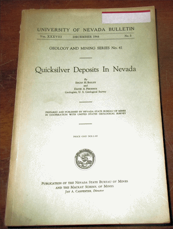
Bailey E. H. and Phoenix D. A. 1944 QUICKSILVER DEPOSITS IN NEVADA Nevada Bureau of Mines Bulletin #41 8vo, in wraps as issued, wraps with small blank label in corner, some wear, rear wrap detached but present with the pocket maps, contents good with 206 pp., 23 plates (all are folding maps in the rear pocket), and 16 figures. Scarce to find with the maps intact. Price: $30.00 (stock#NVBMB41)
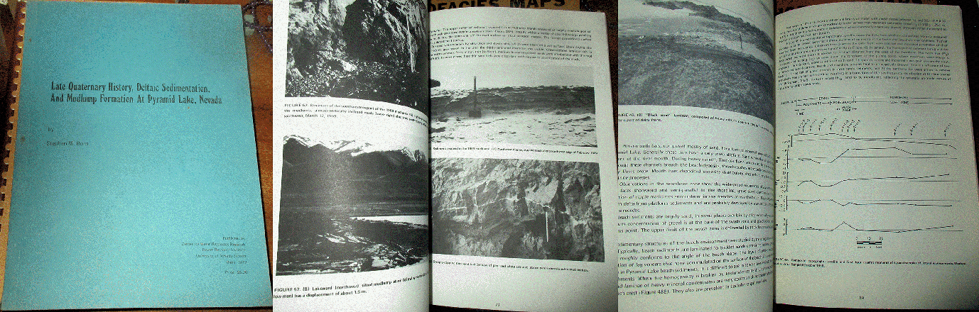
Born S. M. 1972 LATE QUATERNARY HISTORY, DELTAIC SEDIMENTATION AND MUDLUMP FORMATION AT PYRAMID LAKE NEVADA published by Unv. Nevada 4to, in wraps as issued, some external wear, contents good with 97 pp., 67 figures. A fantastic study on the sedimentology of marginal lacustrine deposits. Price: $30.00 (stock#sed32)
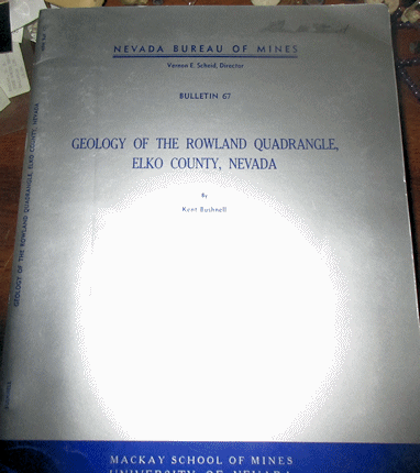
Bushnell K. 1967 GEOLOGY OF THE ROWLAND QUADRANGLE ELKO COUNTY NEVADA Nevada Bureau of Mines Bulletin #67 4to wraps with some external wear, faded stamp of former owner, contents good with 38 pp., 1 plate (large folding map in rear pocket), 3 figs, includes discussion of the area's ore deposits. Price: $20.00 (stock#NVBMB67)

Cornwall H. R. 1972 GEOLOGY AND MINERAL DEPOSITS OF SOUTHERN NYE COUNTY NEVADA NV Bur. Mines Bull. #77 4to, wraps, light wear, very good, 49 pp., 2 plts (pocket maps), 2 figs. Price: $30.00 (stock#NVBMB77)
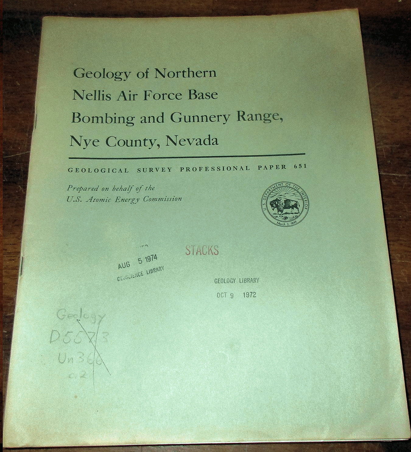
Ekren E. B. 1971 GEOLOGY OF NORTHERN NELLIS AIR FORCE BASE BOMBING AND GUNNERY RANGE NYE COUNTY NEVADA U. S. Geological Survey Professional Paper #651 4to, in wraps as issued, some external wear, stamps to wraps, ex-lib copy, contents good, 91 pp., 1 plate (large map) and 16 figs. Price: $25.00 (stock#PP651)
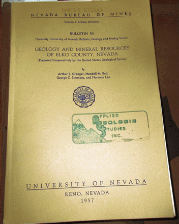
Granger A. E. et al. 1957 GEOLOGY AND MINERAL RESOURCES OF ELKO COUNTY NEVADA Nevada Bureau of Mines Bulletin #54 8vo, in wraps as issued, faded stamps to wraps, contents good with 190 pp., 19 plates, 23 figures including large folding map in rear pocket. Price: $30.00 (stock#NVBMB54)
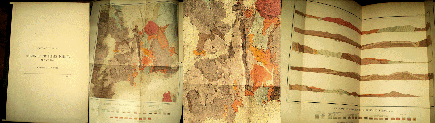
Hague A. 1883 ABSTRACT OF REPORT ON THE GEOLOGY OF THE EUREKA DISTRICT NEVADA from USGS 3rd Ann Rpt, 4to, spine with cloth tape, light wear, vg, With 54 pp. 2 plts including large colored folding map. Scarce.
Price: $35.00 (stock#NV35)

Hobbs S. W. and Clabaugh S. E. 1946 TUNGSTEN DEPOSITS OF THE OSGOOD RANGE HUMBOLDT COUNTY NEVADA Nevada Bur. Mines Bulletin #40 8vo, wraps as issued with discrete stamps, some external wear, contents good with 32 pp. and large folding pocket map. Price: $20.00 (stock#NVBMB40)

Humphrey F. L. 1945 GEOLOGY OF THE GROOM DISTRICT LINCOLN COUNTY NEVADA Nevada Bureau of Mines Bulletin, 8vo, in wraps as issued, light wear, contents good with 53 pp., 17 figures including several maps/charts in rear pocket, of the Groom District before it was rescinded from public access and turned into Area 51. Scarce.
Price: $25.00 (stock#NVBMBgrroom)

Humphrey F. L. 1960 GEOLOGY OF THE WHITE PINE MINING DISTRICT, WHITE PINE COUNTY, NEVADA Nevada Bureau of Mines Bulletin #57 8vo, in wraps as issued, from a old mining company library with company name written
on front wrap with a market else some external wear, contents good with 120 pp., 2 plates (folding maps in rear pocket), and 25 figures. Contains much on the Silver - Lead and other precious metal ore deposits of the District.
Price: $25.00 (stock#NVBMB57)

Jerome and Cook, 1967 RELATION OF SOME METAL MINING DISTRICTS IN THE WESTERN UNITED STATES TO REGIONAL TECTONIC ENVIRONMENTS AND IGNEOUS ACTIVITY NV Bur. Mines Bull. #69 4to, wraps with signature else light wear, vg, w/ 35 pp., 23 pls. Price: $20.00 (stock#NVBMB69)

Keith W. J. 1977 GEOLOGY OF THE RED MOUNTAIN MINING DISTRICT ESMERELDA COUNTY NEVADA wraps, light wear, fine clean copy with 45 pp., 2 plates, 18 figs. Price: $15.00 (stock#USGSB1423)
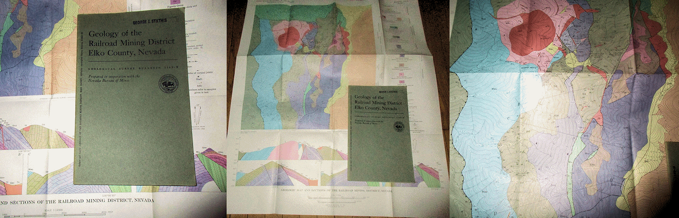
Ketner K. B. and Smith J. F. Jr. 1963 GEOLOGY OF THE RAILROAD MINING DISTRICT ELKO COUNTY NEVADA U. S. Geological Survey Bulletin #1162-B 8vo, in wraps as issued some external wear, contents good with 27 pp., 1 plate 4 figures, the plate being the large folding geologic map of the District in the rear pocket. Includes a section on the ore deposits of this mining district, which include gold silver, lead, copper and other metals.
Price: $20.00 (stock#USGSB1162B)
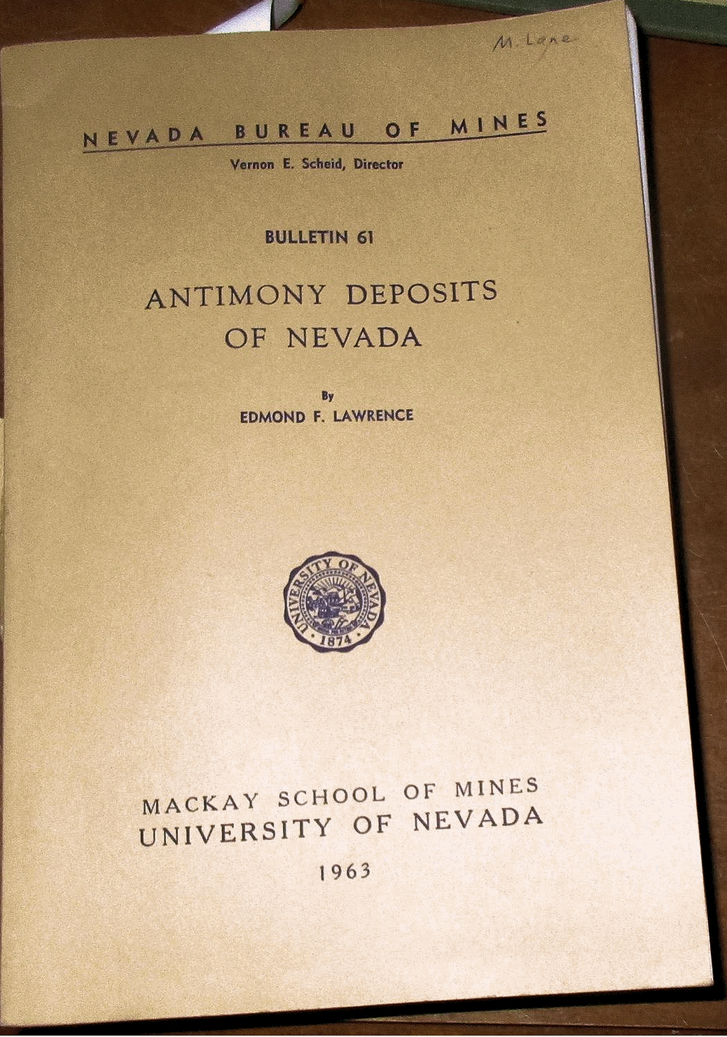
Lawrence E. F. 1963 ANTIMONY DEPOSITS OF NEVADA Nevada Bureau of Mines Bulletin #61 in wraps as issued, light wear, contents vg with 248 pp., 16 plts (including pocket maps), 80 fig. Price: $25.00 (stock#NVBMB61)

Lovering T. G. 1954 RADIOACTIVE DEPOSITS OF NEVADA U. S. Geological Survey Bulletin #1009-C 8vo, in wraps as issued light wear, contents very good with 49 pp., 7 figures. Price: $20.00 (stock#USGSB1009C)

Merriam C. W. 1963 PALEOZOIC ROCKS OF ANTELOPE VALLEY, EUREKA AND NYE COUNTIES, NEVADA USGS Prof. Paper #423 wps light wear vg 67 pp., 2 plts (folding pocket maps), 8 figs. Price: $20.00 (stock#PP423)

Muffler L. J. P. GEOLOGY OF THE FRENCHIE CREEK QUADRANGLE, NORTH-CENTRAL NEVADA USGS Bull. #1179 wps with signature else vg, 99 pp., 1 plt, figs. Price: $20.00 (stock#USGSB1179)
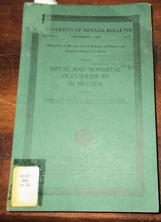
Nevada Bureau of Mines 1932 METAL AND NONMETAL OCCURRENCES IN NEVADA Nevada Bureau of Mines Bulletin #6 8vo, in wraps as issued, rear wrap with corner tear, front wrap with label, ex-lib and some external wear, contents good with 129 pp., folding map bound in. Price: $25.00 (stock#NMBMB06)

Nevada Mining, three (3) volumes. PAPERS PRESENTED AT THE AIME PACIFIC SOUTHWEST MINERAL INDUSTRY CONFERENCE, SPARKS NEVADA, MAY 5-7, 1965 Nevada Bureau of Mines Report 13, three volumes, all 4to size, in wraps, some external wear with light signature, contents very good. Volume 1 (158 pp., figures) on Exploration and Mine Development in Nevada; Volume 2 116 pp., figures) on Mining-Metallurgy-Analysis; Volume 3 (125 pp., figures) on North American Exploration and Mine Development. Hard to find all three volumes together as a complete set.
Price: $30.00 (stock#NVRpt13x3)

Nevada Bureau of Mines 1974 GUIDEBOOK TO THE GEOLOGY OF FOUR TERTIARY VOLCANIC CENTERS IN CENTRAL NEVADA NV Bur. of Mines Report #19 4to, wraps with smudges, some wear BUT the contents are generally clean. With
72 pp., numerous figs, detailed road log of stop, scenic view, and outcrop descriptions, the four main field trip stops are covered in detail and include the Tonopah and Goldfield mining districts. Price: $20.00 (stock#NVBMrpt19)
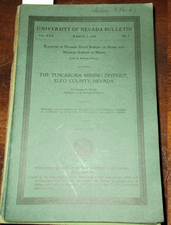
Nolan T. B. 1936 THE TUSCARORA MINING DISTRICT ELKO COUNTY NEVADA Nevada Bureau of Mines Bulletin #25
8vo, in wraps as issued, overall light wear, Charles Park's copy with his inked signature on wrap corner, contents good with 38 pp., 2 plates, and 3 figures. Scarce. Price: $20.00 (stock#NVBMB25)
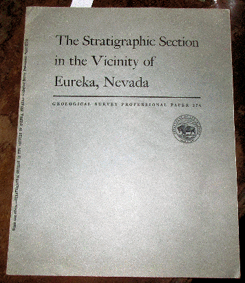
Nolan T. B. et al. 1956 STRATIGRAPHIC SECTION IN THE VICINITY OF EUREKA NEVADA U. S. Geological Survey Professional Paper #275 wps with signature, light wear, very good copy, 78 pp., 2 plates.
Price: $20.00 (stock#PP276)
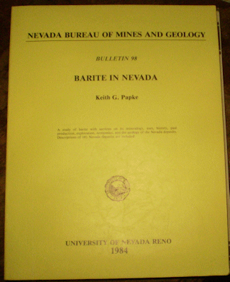
Papke K. G. 1984 BARITE IN NEVADA NV Bur. Mines Bull. #98 4to, wraps, light wear, vg clean copy with 125 pp., 2 plates in rear pocket, 89 figs. Price: $30.00 (stock#NVBMB98)

Roberts R. J. and Arnold D. C. 1965 ORE DEPOSITS OF THE ANTLER PEAK QUADRANGLE HUMBOLDT AND LANDER
COUNTIES NEVADA U. S. Geological Survey Professinal Paper 459-B 4to, text and map slip case complete, map case with cracked hinge, text with some external wear, contents good with 94 pp., 19 plts and 19 figs; focused on the gold copper silver and other metallic ore deposits of the area. Price: $40.00 (stock#PP459B)
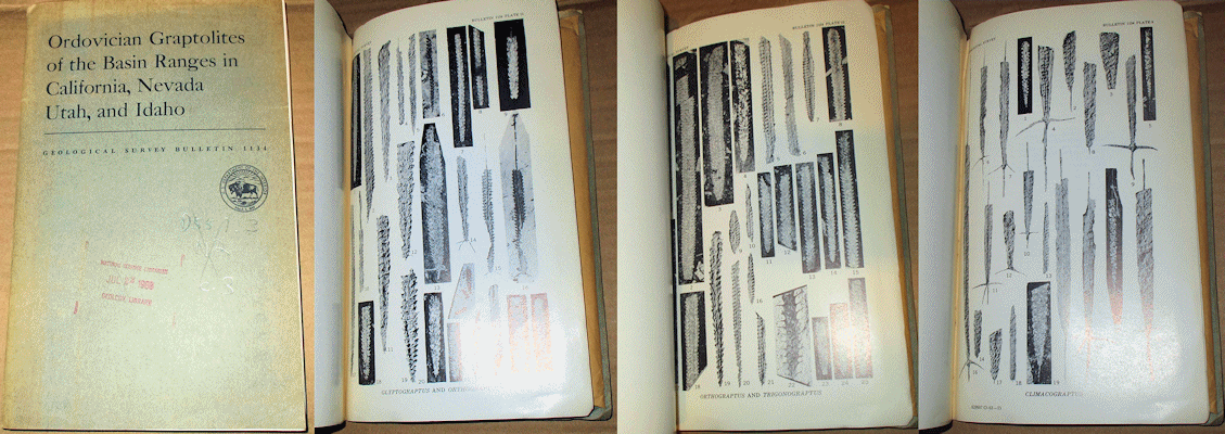
Ross R. J. and Berry W. B. N. 1963 ORDOVICIAN GRAPTOLITES OF THE BASIN RANGES IN CALIFORNIA, NEVADA, UTAH AND IDAHO U. S. Geological Survey Bulletin #1134 wraps, some wear, ex-lib with stamps and markings, contents good with 177 pp., 14 plates, 3 figures. Price: $15.00 (stock#USGSB1134)
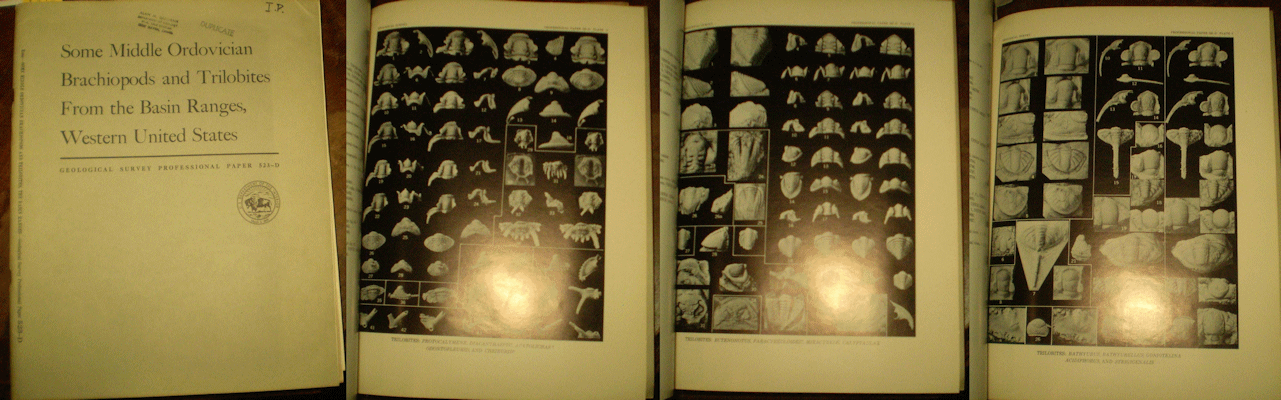
Ross R. J. Jr. 1967 SOME MIDDLE ORDOVICIAN BRACHIOPODS AND TRILOBITES FROM THE BASIN RANGES, WESTERN UNITED STATES USGS Prof. Paper #523-D wraps with stamps, ex-lib, overall light wear, vg, 43 pp., 11 plates of fossils. Price: $20.00 (stock#PP523D)

Ross R. J. Jr. and Shaw F. C. 1972 DISTRIBUTION OF THE MIDDLE ORDOVICIAN COPENHAGEN FORMATION AND ITS
TRILOBITES IN NEVADA U. S. Geological Survey Professional Paper #749 4to, in wraps, front wrap with stamp and signature of former owner, contents good with 33 pp., 8 plts of fossil trilobites, 3 figs.
Price: $20.00 (stock#PP749)

Schrader F. C. 1912 NOTES ON THE ANTELOPE DISTRICT NEVADA USGS Bull. #530-J wps with signature, light+ wear, vg, 14 pp., 1 plt, 2 figs. Price: $15.00 (stock#USGSB530J)

Schrader F. C. 1931 SPRUCE MOUNTAIN DISTRICT, ELKO COUNTY AND CHERRY CREEK (EGAN CANYON) DISTRICT, WHITE PINE COUNTY Nevada Bureau of Mines Bulletin, 8vo, in wraps as issued, some wear, contents good with 39 pp., 10 figs including several folding maps bound into text. Scarce. Price: $25.00 (stock#NVBMBspru)

Silberling N. J. and Wallace R. E. 1969 STRATIGRAPHY OF THE STAR PEAK GROUP (TRIASSIC) AND OVERLYING LOWER MESOZOIC ROCKS HUMBODLT RANGE NEVADA U. S. Geological Survey Professional Paper #592 4to, in wraps as issued some wear, mostly being bumped/creased page corners at lower-right margin of volume. Else contents good with 50 pp., 2 plates and 15 figures on the late middle Triassic to Late Triassic strata of this region of Nevada. A classic report.
Price: $20.00 (stock#PP592)

Smith G. H. 1943 THE HISTORY OF THE COMSTOCK LODE 1850 - 1920 Nevada Bureau of Mines Bulletin #37 8vo, in
wraps as issued, wraps with signature of former owner, some wear, contents good with 297 pp., frontis plate, and 22 additional illustrations in text. Price: $30.00 (stock#NVBMB37)

Spurr J. E. 1906 ORE DEPOSITS OF THE SILVER PEAK QUADRANGLE NEVADA U. S. Geological Survey Professional
Paper #55 4to, bound in old archival wraps, long-defunct mining company stamp to title page and margins or verso of a few plates else contents good with 174 pp., 33 of 34 plates, and 40 figures (the large folding map is lacking). The volume is an exhaustive study of the Silver, Gold and other metalliferous mines and ore deposits of the region (Esmerelda County) as then-known. Hard to find in any condition. Price: $50.00 (stock#PP55)
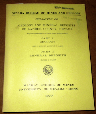
Stewart J. H. et al. 1977 GEOLOGY AND MINERAL DEPOSITS OF LANDER COUNTY NEVADA PART 1- GEOLOGY; PART 2 - ORE DEPOSITS Nevada Bureau of Mines Bulletin 88 wraps with partly faded and smudged stamps of former owner, contents with light wear and very good with 106 pp., 3 plates, 23 figures including the large folding maps in rear pocket. Price: $25.00 (stock#NVBMB88)
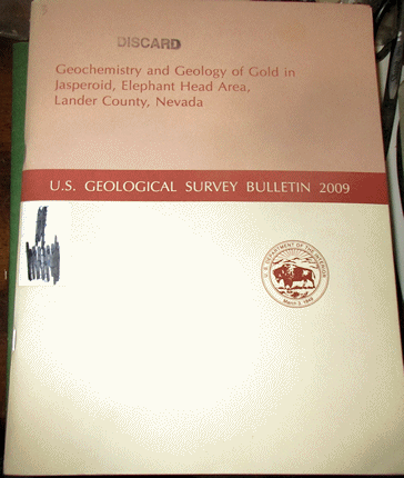
Theodore T. G. and Jones G. M. 1992 GEOCHEMISTRY AND GEOLOGY OF GOLD IN JASPEROID, ELEPHANT HEAD AREA, LANDER COUNTY NEVADA U. S. Geological Survey Bulletin #2009 4to in wraps as issued, ex-lib with stamp and label crossed out, some external wear, contents good with 53 pp., 21 figs and folding geologic map bound in at rear. Price: $20.00 (stock#USGSB2009nv)

Thompson G. A. and White D. E. 1964 REGIONAL GEOLOGY OF THE STEAMBOAT SPRINGS AREA WASHOE COUNTY NEVADA U. S. Geological Survey Professinal Paper 458-A 4to, in wraps as issued, some wear, ex-lib. copy, contents good with 52 pp., 2 plates, 19 figures, the plates being fold out maps in the rear pocket, one of which is a geologic map of the Virginia City quadrangle. Price: $25.00 (stock#PP458A)
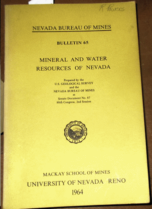
USGS and Nevada Bureau of Mines 1964 MINERAL AND WATER RESOURCES OF NEVADA NV Bur. Mines Bull. #65 8vo, some exterior wear with faded stamp, contents vg with 313 pp., 60 figs. Price: $30.00 (stock#NVBMB65)
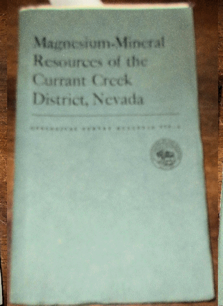
Vitaliano C. J. 1951 MAGNESIUM-MINERAL RESOURCES OF THE CURRANT CREEK DISTRICT NEVADA USGS Bull. #978-A 8vo, wraps, some wear, contents good, 25 pp., 8 plts, 6 figs on the mineral and ore deposits of this area located southwest of Ely Nevada. Price: $15.00 (stock#USGSB978A)
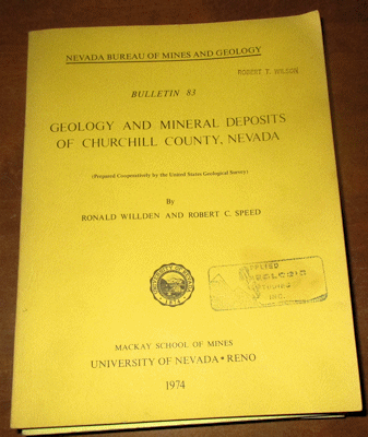
Willden R. et al. 1974 GEOLOGY AND MINERAL DEPOSITS OF CHURCHILL COUNTY NEVADA Nevada Bureau of Mines Bulletin #83 wraps with faded stamp, some wear, contents very good with 95 pp., 5 plates, 19 figures including the large folding map in the rear pocket. Price: $25.00 (stock#NVBMB83)
NEW JERSEY NEW YORK PENNSYLVANIA
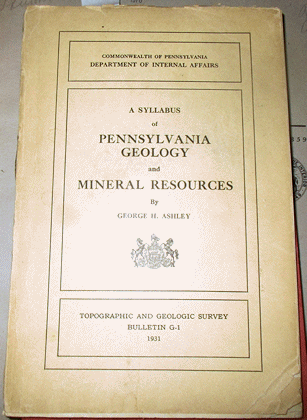
Ashley G. H. 1931 A SYLLABUS OF PENNSYLVANIA GEOLOGY AND MINERAL RESOURCES Pennsylvania Geological Survey Bulletin G-1 8vo, wraps with some external wear, chipped corner to wrap and first few pages, contents good with 159 pp., 2 plates, and 118 figs. Price: $25.00 (stock#PAGSBG1)
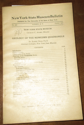
Balk R. 1932 GEOLOGY OF THE NEWCOMB QUADRANGLE New York State Museum Bulletin #290 wraps with some wear, light wrinkling but contents clean and unaffected with 106 pp., 38 figures + folding map in the pocket, focused on this portion of the southern Adirondack Mountains. Price: $25.00 (stock#NYSMB291)
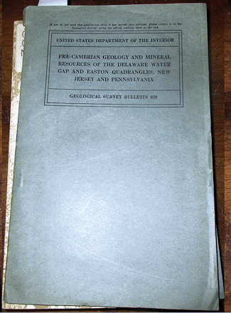
Bayley W. S. 1941 PRECAMBRIAN GEOLOGY AND MINERAL RESOURCES OF THE DELAWARE WATER GAP AND EASTON QUADRANGLES, NEW JERSEY AND PENNSYLVANIA U. S. Geological Survey Bulletin #920 8vo, wrps with some wear, marginal tears, contents good, 98 pp., 5 plts, 4 figs including large folding map. With much on minerals old mines, prospects, and rock quarries of the region. Price: $20.00 (stock#USGSB920)
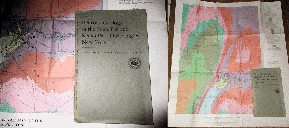
Bergen M. J. 1964 BEDROCK GEOLOGY OF THE PENN YAN AND KEUKA POINT QUADRANGLES NEW YORK U. S. Geological Survey Bulletin #1161-G 8vo, in wraps as issued, some wear,contents good with 35 pp., 2 plates (large folding bedrock maps in the rear pocket), 3 figures, on the geology of this part of New York State located in the Finger Lakes region. The exposed stratigraphy ranges from the Moscow Formation at base (the fossil-rich Windom Member) into Upper Devonian age strata. Price: $20.00 (stock#USGSB1161G)
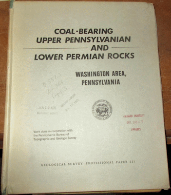
Berryhill H. L. et al. 1971 COAL BEARING UPPER PENNSYLVANIAN AND LOWER PERMIAN ROCKS WASHINGTON AREA PENNSYLVANIA U. S. Geological Survey Professional Paper #621 text and map slip case, slip case with some wear, ex-lib., contents very good with 47 pp., 8 plates (folding maps and charts), 25 figures and all focused on the Conemaugh, Monogahela and Dunkard Groups of southwestern Pennsylvanian. Price: $20.00 (stock#PP621)
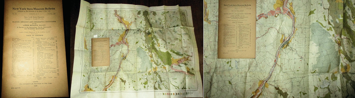
Brigham A. P. 1929 GLACIAL GEOLOGY AND GEOGRAPHIC CONDITIONS OF THE LOWER MOHAWK VALLEY- A SURVEY OF THE AMSTERDAM, FONDA, GLOVERSVILLE AND BROADALBIN QUADRANGLES New York State Museum Bulletin #280 wps light wear, vg-fine copy with 133 pp., 72 plates. Price: $30.00 (stock#NYSMB280)

Buddington A. F. and Whitcomb L. 1941 GEOLOGY OF THE WILLSBORO QUADRANGLE NEW YORK New York State Museum Bulletin #325 8vo, in wraps as issued, stamp of a former mining company to front wrap with penciled notation else some external wear, contents good with 137 pp., 46 figs on the geology of this region of northeastern New York along Lake Champlain. Price: $25.00 (stock#NYSMB325)
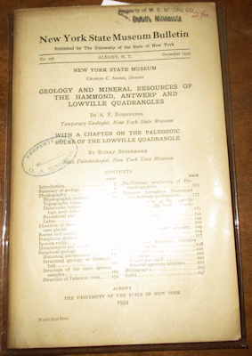
Buddington A. F. and Ruedemann R. 1934 GEOLOGY AND MINERAL RESOURCES OF THE HAMMOND, ANTWERP AND LOWVILLE QUADRANGLES WITH A CHAPTER ON THE PALEOZOIC ROCKS OF THE LOWVILLE QUADRANGLE New York State Museum Bulletin #296 in wraps with former owner's stamps, contents very good with 251 pp., 54 figs, 4 maps in pocket. Includes section on minerals and economic resources, and much of Adirondack igneous rocks.
Price: $25.00 (stock#NYSMB291)
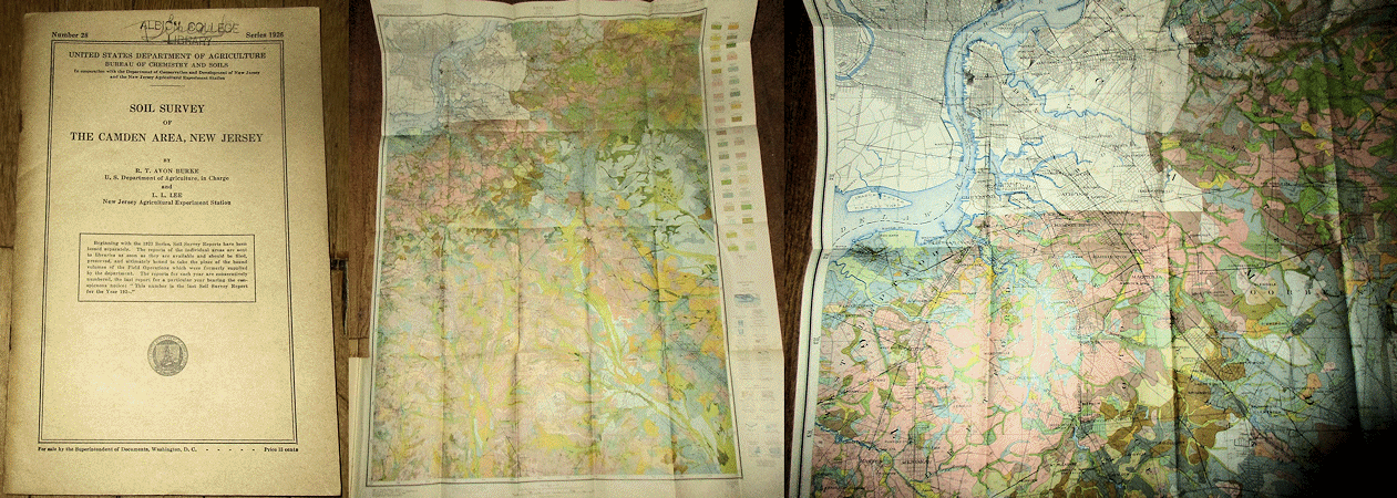
Burke R. T. A. and Lee L. L. 1926 SOIL SURVEY OF THE CAMDEN AREA NEW JERSEY published by the U. S. Dept.
Agriculture, 8vo, stamp to wraps, ex-lib, text report in wraps as issued with 35 pp. and the large folding map of the region bound in at rear. The large folding map is in vg condition. Scarce. Price: $45.00 (stock#USDA1926no28)

Butts C. 1910 WARREN FOLIO, PENNSYLVANIA-NEW YORK USGS Atlas Folio #172 wraps with faded stamp else light wear, vg, 11 pp. Descriptive Text, Topographic Map, Areal Geology Map, Economic Geology Map.
Price: $35.00 (stock#AF172)
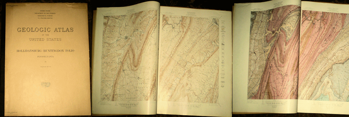
Butts C. 1945 HOLLIDAYSBURG – HUNTINGDON PENNSYLVANIA 1945 USGS Atlas Folio #227 wraps, creased area to upper corner else light wear, vg with 20 pp. Descriptive Text, double paged Topographic , Areal Geologic and Structural Geology Maps, Columnar Section Sheet and 3 folio sized pages of outcrop photos.
Price: $35.00 (stock#AF227)
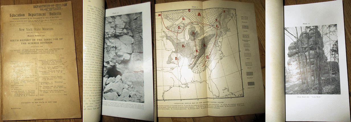
Clarke J. M. et al. 1910 SIXTH ANNUAL REPORT OF THE DIRECTOR OF THE SCIENCE DIVISION 1909 New York State Museum Bulletin #140 8vo, wraps with some wear, dust soiling, old dept. stamp to wraps, contents good with 229 pp., and numerous plates and figures. Some of the more notable contents include: JOINT CAVES OF VALCOUR ISLAND – THEIR AGE AND ORIGIN By Hudson; DOWNWARD OVERTHRUSY FAULT AT SAUGERTIES By Chadwick; ORIGIN OF COLOR IN THE VERNON SHALE By Miller; ON THE SYMMETRIC ARRANGEMENT OF ELEMENTS OF THE PALEOZOIC PLATFORM OF NORTH AMERICA By Ruedemann; AGE AND RELATIONS OF THE LITTLE FALLS DOLOMITE (CALCIFEROUS) OF THE MOHAWK VALLEY By Ulrich and Cushing, several reports on Native American Indians, and more. Price: $25.00 (stock#NYSMB140)
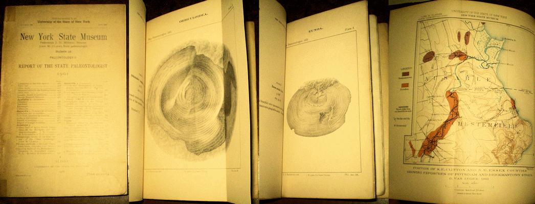
Clarke J. M. 1902 REPORT OF THE STATE PALEONTOLOGIST NYSM Bull. #52 wraps with some wear, contents vg and diverse, with 693 pp., a score of plates, figs focused on diverse aspects of the Paleozoic faunas of New York State. Price: $45.00 (stock#NYSMB52)

Cook G. H. 1877 ANNUAL REPORT OF THE STATE GEOLOGIST FOR THE YEAR 1876 NJ Geol. Surv., 8vo, wraps with crease, old tape along spine, old stamps to wraps, contents good, 56 pp. and folding map. Seldom seen, and sought after for the large folding map of the Passaic River region. Price: $30.00 (stock#NJAR76)
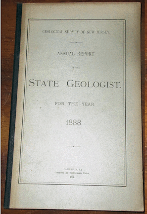
Cook G. H. 1890 ANNUAL REPORT OF THE STATE GEOLOGIST FOR THE YEAR 1888 original stiff wraps as issued, overall light wear and a very good copy with 87 pp., small folding map and additional figs.
Price: $25.00 (stock#NJAR88)

Cushing, H. P. 1905 GEOLOGY OF THE NORTHERN ADIRONDACK REGION NYSM Bull. #95 wps, spine ends with archival repair else light wear, vg copy, 453 pp., 18 plts. Price: $35.00 (stock#NYSMB085)
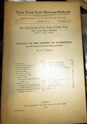
Cushing H. P. 1916 GEOLOGY OF THE VICINITY OF OGDENSBURG (BRIER HILL OGDENSBURG, & RED MILLS QUAD-RANGLES) New York State Museum Bulletin #191, in wraps, ownership name on wrap else light wear, clean with 64 pp., 7 plates including map + figs. Price: $25.00 (stock#NYSMB191)
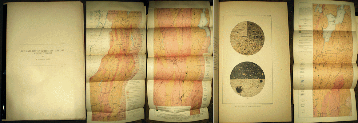
Dale T. N. 1899 THE SLATE BELT OF EASTERN NEW YORK & WESTERN VERMONT from 19th Annual Report of the U. S. Geological Survey, 4to, spine with archival tape else light wear, very good and clean copy with 155 pp., 30 plates, 10 figures with nice photos and maps. One of the more important contributions to the northern New England Slate Quarry Industry and also Taconic geology. Price: $30.00 (stock#NY21)
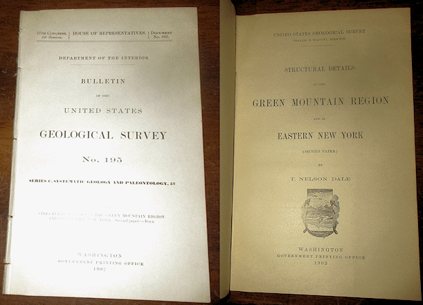
Dale T. N. 1902 STRUCTURAL DETAILS IN THE GREEN MOUNTAIN REGION AND IN EASTERN NEW YORK U. S. Geological Survey Bulletin #195 8vo, no wraps, light wear, contents good with 69 pp., 4 plates, 8 figures.
Price: $25.00 (stock#USGSB195)

Dale T. N. 1905 GEOLOGY OF THE HUDSON VALLEY BETWEEN THE HOOSIC AND THE KINDERHOOK U. S. Geological Survey Bulletin #242 8vo, no wraps, cloth tape along spine, some external wear, contents good with 63 pp., 3 plates, 17 figures. One of the plates is a large rectangular colored folding map of the mid-Hudson Valley region.
Price: $25.00 (stock#USGSB242)
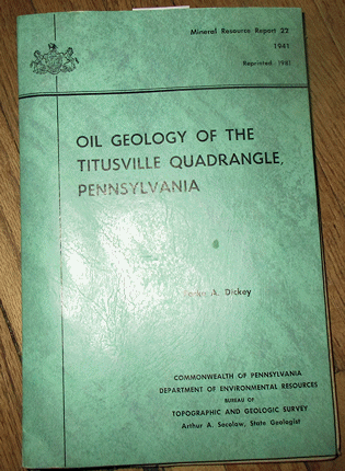
Dickey P. A. 1941 (1981 reprint) OIL GEOLOGY OF THE TITUSVILLE QUADRANGLE PENNSYLVANIA Pennsylvania Geological Survey Mineral Resources Report #22 8vo, in wraps as issued, light wear, contents vg with 87 pp., 6 plates, 13 figures, additional measured or well log sections, including fold out maps and charts in rear pocket.
Price: $25.00 (stock#PAGSMR22)
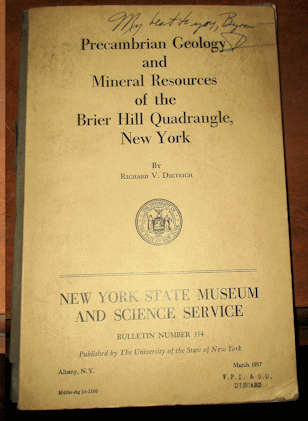
Dietrich R. V. 1957 PRECAMBRIAN GEOLOGY AND MINERAL RESOURCES OF THE BRIER HILL QUADRANGLE NEW YORK New York State Museum Bulletin #354 8vo, in wraps with presentation signature (though apparently not from author), wraps a bit dust soiled from sitting unattended on a shelf for years, contents vg with 121 pp., 21 plts, 7 figs covering a mineral rich area in northern New York near the St. Lawrence River. Price: $30.00 (stock#NYSMB354)
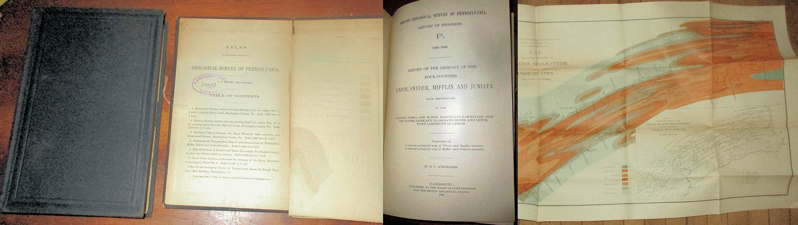
D’Invilliers E. V. 1891 REPORT ON THE GEOLOGY OF THE FOUR COUNTIES UNION SYNDER MIFFLIN AND JUNIATA Pennsylvania Geological Survey, 2nd Series Volume F3, text and atlas complete. Text in original brown cloth, gilt title on spine faded per usual else a very good, clean and unmarked copy with 420 pp. with folding map in each front and rear pockets. The accompanying atlas is in the original brown cloth slip case; the covers of the slip case are loose/separated and I am not sure if the atlas was issued like that, or a thin spine cloth once held the two covers. Regardless, the atlas is complete with the six (6) folding maps and sections listed on the table of contents, which also has an old U. S. Geo-logical Survey Library stamp dated 1896. Scarce to find with the atlas intact. Price: $80.00 (stock#PA2ndF3)

Fisher D. W. 1957 MOHAWKIAN (MIDDLE ORDOVICIAN) BIOSTRATIGRAPHY OF THE WELLS OUTLIER HAMILTON COUNTY NEW YORK New York State Museum Bulletin #359 8vo, in wraps as issued, former owner's name stamp partly faded on front wrap else light wear, contents very good with 33 pp., 6 plts. The report covers an area of downfaulted fossil rich strata along the flanks of the Adirondacks. Price: $20.00 (stock#NYSMB359)

Gallagher D. 1937 ORIGIN OF THE MAGNETITE DEPOSITS AT LYON MOUNTAIN NEW YORK New York State Museum Bulletin #311 8vo, wraps with stamps, ex-dept. library copy else vg, 85 pp., 17 figs. Price: $25.00 (stock#NYSMB311)
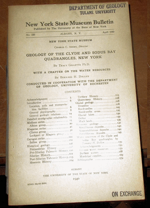
Gillette T. H. et al. 1940 GEOLOGY OF THE CLYDE AND SODUS BAY QUADRANGLES NEW YORK New York State Museum Bulletin #320 8vo, in wraps, ex-department library with stamp else light wear, contents very good with 179 pp., 49 figures, and 2 maps. Includes extensive coverage with good locality information for Ordovician through Silurian sections of the region including the trilobite rich Rochester Shale and adjacent formations.
Price: $30.00 (stock#NYSMB320)
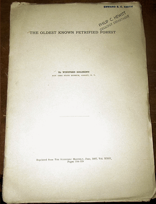
Goldring W. 1927 THE OLDEST KNOWN PETRIFIED FOREST reprinted from Scientific Monthly and on the Gilboa Petrified Forest (Devonian age) of New York, 8vo, in wraps as issued, wraps with former ownership stamps and some wear, contents good with 15 pp., 14 figures, most of which are outcrop and fossil photographs. Scarce.
Price: $20.00 (stock#NY32)
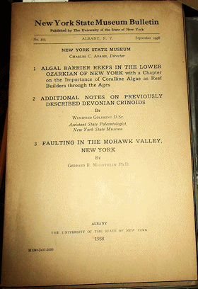
Goldring W. et al. 1938 New York State Museum Bulletin #315, in wraps, ex-lib, contents very good with 125 pp., 30 figs and includes the following important papers: ALGAL BARRIER REEFS IN THE LOWER OZARKIAN OF NEW YORK and ADDITIONAL NOTES ON PREVIOUSLY DESCRIBED DEVONIAN CRINOIDS By Goldring, W.; and FAULTING IN THE MOHAWK VALLEY By Megathlin, G. R. 1938. A nice copy. Price: $25.00 (stock#NYSMB315)

Gray C. and Lapham D. M. 1961 GUIDE TO THE GEOLOGY OF CORNWALL PENNSYLVANIA PA Geol. Surv. Bull. G-35 wps, ex-library else light wear, vg, 18 pp., 2 plts, map. Price: $15.00 (stock#PAGSG35)

Hall James 1861 NATURAL HISTORY OF NEW YORK PART VI PALEONTOLOGY VOLUME III. CONTAINING DESCRIPTIONS AND FIGURES OF THE ORGANIC REMAINS OF THE LOWER HELDERBERG GROUP AND THE ORISKANY SANDSTONE, 1855-1859. PART I: TEXT, and PART II PLATES. 532 pp. + numerous figs., bound in original gilt-embossed cloth, spine cover missing, wear to boards, with a small area damaged at upper front margin, occasional light tide mark to contents, lower outer page corners become increasingly darkened at around p. 300. Overall a good only copy for contents. PART II is bound in period marbled boards with cloth spine and original spine label, now faded, affixed, ex-lib with period bookplate on paste down and small blind stamp with pencil signature on title page, page edges with scattered dust soiling but overall a vg copy of the plate volume, which is notorious for becoming disbound and/or loosing its spine cover due to its thickness. With 120 plates of fossils. Price: $95.00 (stock#HallVol3setP)

Hobbs W. H. 1905 THE CONFIGURATION OF THE ROCK FLOOR OF GREATER NEW YORK U. S. Geological Survey Bulletin #270 8vo, in limited issue red cloth binding, cloth margin at top of covers with some soiling,contents good except for a gift inscription that fills most of the inside of the front cover (see photos). With 96 pp., 5 plates, 6 figures. Scarce. Price: $25.00 (stock#USGSB270)
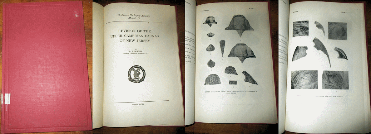
Howell B. F. 1945 REVISION OF THE UPPER CAMBRIAN FAUNAS OF NEW JERSEY Geological Society of America Memoir #12 8vo, in cloth as issued, light wear, ex-dept library copy, contents very good with 46 pp., 8 plates of fossils, mostly trilobite fragments. Price: $25.00 (stock#GSAMem12)
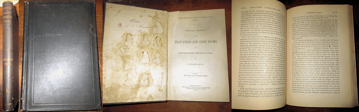
Hunt T. S. 1878 SPECIAL REPORT ON THE TRAP DKYES AND AZOIC ROCKS OF SOUTHEASTERN PENNSYLVANIA published by the Pennsylvania Geological Survey, 2nd Series, as Volume E. 8vo, in original cloth, some external wear,
inside of front cover with some soiling, the blank, front free end paper was torn out but the contents of volume are clean and very good, with 233 pp. Price: $35.00 (stock#PAGS2ndE)

Johnson M. E. 1929 TOPOGRAPHIC AND GEOLOGIC ATLAS OF PENNSYLVANIA, PITTSBURGH QUADRANGLE Pennsylvania Geological Survey Atlas Series #27 8vo, text with map pocket, some wear, contents good with 226 pp., 33 plts including the 4 maps and charts in the front pocket. Scarce. Price: $40.00 (stock#PAGSA27)

Jones M. 1969 A LITHOSTRATIGRAPHIC, PETROGRAPHIC AND CHEMICAL INVESTIGATION OF THE LOWER MIDDLE ORDOVICIAN CARBONATE ROCKS IN CENTRAL PENNSYLVANIA PA Geol. Surv. 4th Series, Bull. G53, text with map slip case, light wear, vg to fine copy, 224 pp., 8 plts. Price: $25.00 (stock#PAGSG53)
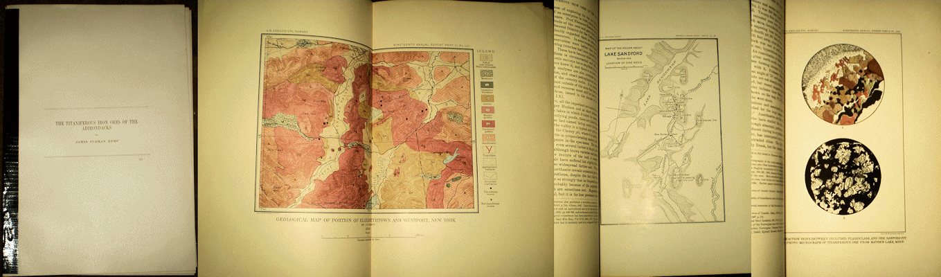
Kemp, J. F. 1899 THE TITANIFEROUS IRON ORES OF THE ADIRONDACKS from 19th Annual Report of the U. S. Geological Survey, 4to, spine with archival tape else light wear, very good and clean copy with 47 pp., 9 plates.
Price: $25.00 (stock#NY07)

Kummel H. B. 1907 ANNUAL REPORT OF THE STATE GEOLOGIST FOR THE YEAR 1906 8vo, in stiff wraps as issued, some external wear, bookplate of former owner inside front cover else contents good with 192 pp., 32 plates, 9 figures. Contents with much on the Triassic and Jurassic rocks of the Newark Basin including THE ORIGIN AND RELATIONS OF THE NEWARK ROCKS; THE NEWARK (LATE TRIASSIC) COPPER ORES OF NEW JERSEY; PROPERTIES OF TRAP ROCKS FOR ROAD CONSTRUCTION (all by J. V. Lewis); THE GLASS SAND INDUSTRY OF NEW JERSEY by Kummel and Gage; THE FIRE-RESISTING QUALITIES OF SOME NEW JERSEY BUILDING STONES By McCourt, and NOTES ON THE MINING INDUSTRY by Kummel. Scarce. Price: $30.00 (stock#NJAR06)
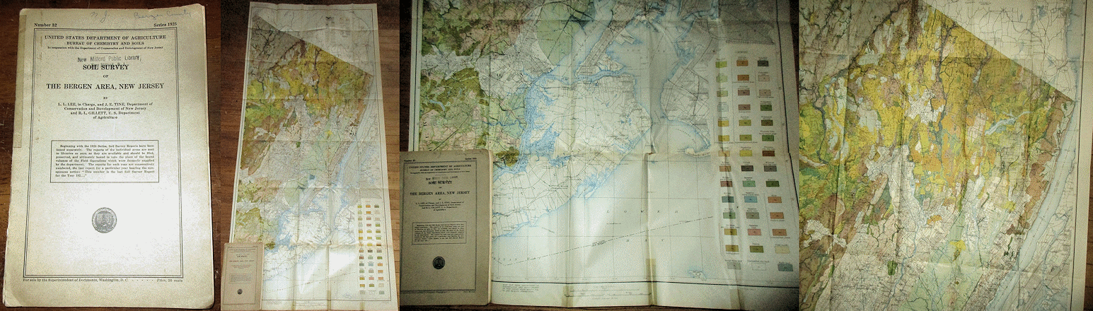
Lee L. L. et al. 1925 SOIL SURVEY OF THE BERGEN AREA NEW JERSEY published by the USDA and includes both the report and large folding colored map. Some external wear, old tape repair along spine, light notations on front wrap, some wear to contents but overall good with 28 pp. text and the large folding map which has some wear, mostly being a short tear to blank margin and small corner crease separation (a few mm) but overall is good to very good and covers the Jersey side of the Hudson River opposite New York City. Scarce. Price: $60.00 (stock#NJ33)
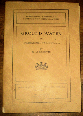
Leggette R. M. 1936 GROUND WATER IN NORTHWESTERN PENNSYLVANIA PA Geol. Surv. Report W-3 wraps light wear, vg, 215 p., 9 plates., geol. map, scale 1:380,160. Price: $25.00 (stock#PAGSW3)
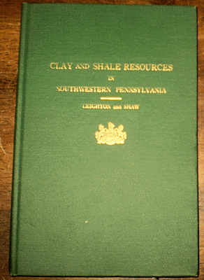
Leighton H. 1932 CLAY AND SHALE RESOURCES IN SOUTHWESTERN PENNSYLVANIA PA Geol. Surv. Mineral Resource Rpt. #17 light wear, contents fine, 190 pp., 1 plt. Price: $25.00 (stock#PAGSMR17)
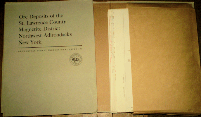
Leonard B. F. and Buddington A. F. 1964 ORE DEPOSITS OF THE ST. LAWRENCE COUNTY MAGNETITE DISTRICT, NORTHWEST ADIRONDACKS, NEW YORK USGS Prof. Paper #377 text and map slip case with light wear, signature else vg. With 259 pp., 21 plts, 31 figs. Price: $35.00 (stock#PP377)
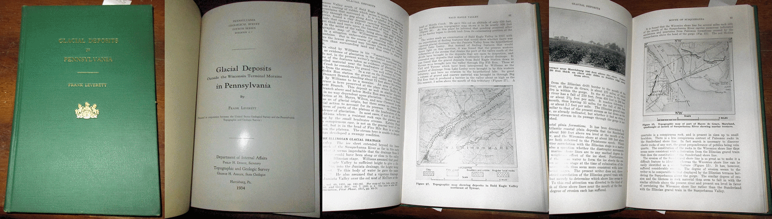
Leverett F. 1934 GLACIAL DEPOSITS IN PENNSYLVANIA Pennsylvania Geological Survey Bulletin #G-7 8vo, in green cloth with gilt design and titles as issued, contents good, and a clean, unmarked copy with 123 pp., 2 plts including folding map, and 38 figs on the glacial and terminal moraine deposits that cover the northern half of the State. A nice copy. Price: $30.00 (stock#PA4thBG7)
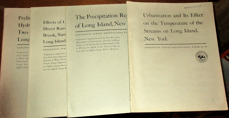
Long Island New York, four (4) reports on Water Resources, all published as Professional Papers by the U. S. Geological Survey, all with some wear, most are ex-library, contents are good to very good in all. They are: (1) URBANIZATION AND ITS EFFECT N THE TEMPERATRE OF THE STREAMS ON LONG ISLAND, NEW YORK with 110 pp., 39 figures; (2) THE PRECIPITATION REGIME OF LONG ISLAND NEW YORK with 21 pp., 1 plate (folding map in rear pocket), 23 figures; (3) EFFECTS OF URBAN DEVELOPMENT ON DIRECT RUNOFF TO EAST MEADOW BROOK, NASSAU COUNTY LONG ISLAND, NEW YORK with 14 pp., 1 plate, 5 figures; and (4) PRELIMINARY RESULTS OF HYDROLOGIC STUDIES AT TWO RECHARGE BASINS ON LONG ISLAND NEW YORK with 17 pp., 15 figures. A nice set of regional hydrology reports. Price: $25.00 (stock#NYLIppx4)
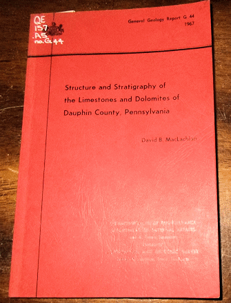
MacLachlan D. B. 1967 STRUCTURE AND STRATIGRAPHY OF THE LIMESTONES AND DOLOMITES OF DAUPHIN COUNTY PENNSYLVANIA Pennsylvania Geological Survey Bulletin G-44 8vo, in wraps as issued, ex-lib else good copy with 168 pp., 1 plate (map in rear pocket), 25 figs focused on the Cambrian and Ordovician strata of the area.
Price: $20.00 (stock#PAGSBG44)
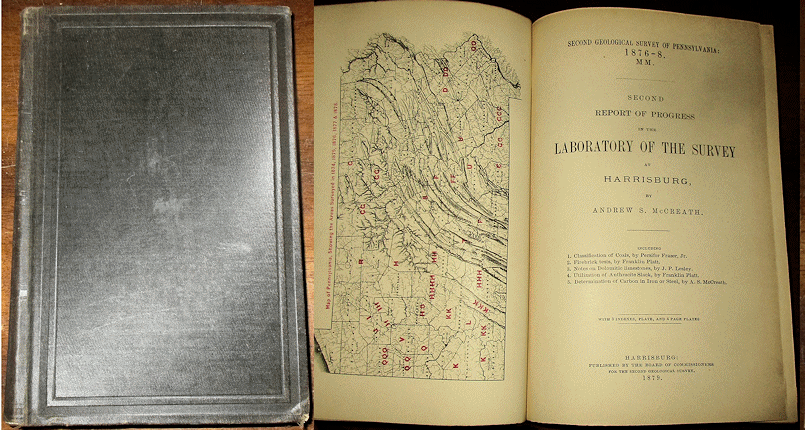
McCreath A. S. 1879 SECOND REPORT OF PROGRESS IN THE LABORATORY OF THE SURVEY AT HARRISBURG Pennsylvania Geol. Surv., 2nd Series, Volume MM 8vo, in cloth as issued, some external wear, gilt spine title faded, front hinge partly cracked but board is firm, minor nick of damage to blank margins of some pages near the beginning but else contents good. With 438 pp., and covers the geochemical and whole rock analyses of rocks, minerals and ores found throughout the State. Price: $30.00 (stock#PA2ndMM)
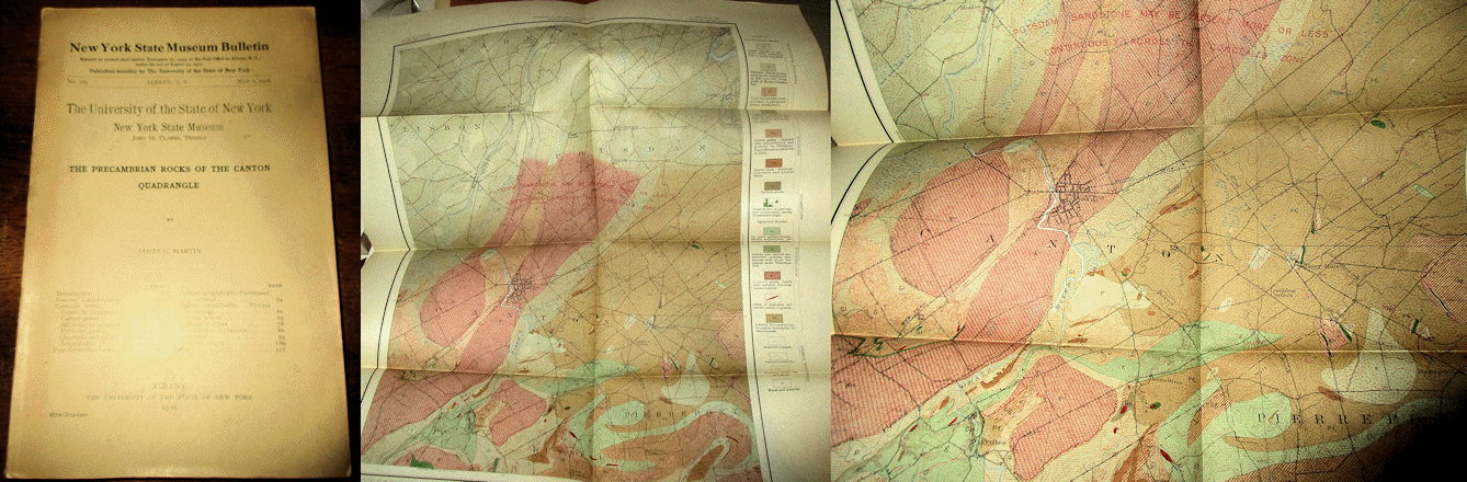
Martin J. C. 1916 THE PRECAMBRIAN ROCKS OF THE CANTON QUADRANGLE New York State Museum Bulletin #185 8vo, wraps as issued, light wear and a very good copy with 112 pp., 19 plts, 30 figs including the large folding geologic map in the rear pocket map. Price: $30.00 (stock#NYSMB185)
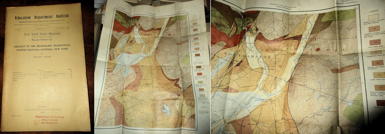
Miller W. J. 1911 GEOLOGY OF THE BROADALBIN QUADRANGLE FULTON - SARATOGA COUNTIES NEW YORK New York State Museum Bulletin #153 8vo, in wraps as issued, small stamp to wrap, contents good with 62 pp., 8 plts, 9 figs and large folding pocket map. Focused on the region along the southeast margin of the Adirondacks. Scarce.
Price: $25.00 (stock#NYSMB153)

Miller W. J. 1916 GEOLOGY OF THE LAKE PLEASANT QUADRANGLE HAMILTON COUNTY NEW YORK NYSM Bulletin #182 8vo, department stamps to wraps, some exterior wear, contents good with 75 pp., 10 plts, 4 figs including folding geologic map in pocket. On the southern Adirondacks region. Price: $30.00 (stock#NYSMB182)
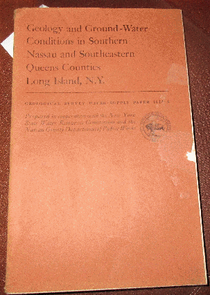
Perlmutter N. M. and Geraghty J. J. 1963 GEOLOGY AND GROUND WATER CONDITIONS IN SOUTHERN NASSAU AND
SOUTHEASTERN QUEENS COUNTIES LONG ISLAND NEW YORK U. S. Geological Survey Water Supply Paper #1613-A
8vo, in wraps as issued, wraps with some wear, short marginal tears, contents good with 205 pp., 7 plates, 21 figures. A must have reference for anyone interested in New York City - Long Ilsand region geology and water resources.
Price: $20.00 (stock#WSP1613Any)
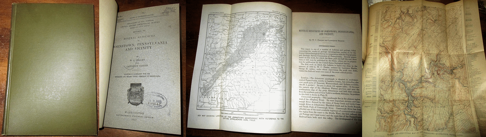
Phalen W. C. and Martin L. 1911 MINERAL RESOURCES OF JOHNSTOWN PENNSYLVANIA AND VICINITY U. S. Geological Survey Bulletin #447 bound in cloth, very good copy with with 142 pp., 7 plates, and 42 figures including large fold out colored map in rear pocket. Map has a separation along one fold crease but no loss to paper and doesn't show when laid flat. Scarce. Price: $25.00 (stock#USGSB447)

Pittsburgh Geological Society and American Association of Petroleum Geologists 1948 FIELD CONFERENCE - NORTHERN PORTION OF THE APPALACHIAN BASIN 4to, in wraps as issued, some external wear, short teat at top of spine, contents good with 121 pp., many illustrations, some of which are folding maps or section sheets with additional maps/charts in rear pocket. Scarce. Price: $30.00 (stock#PA32)
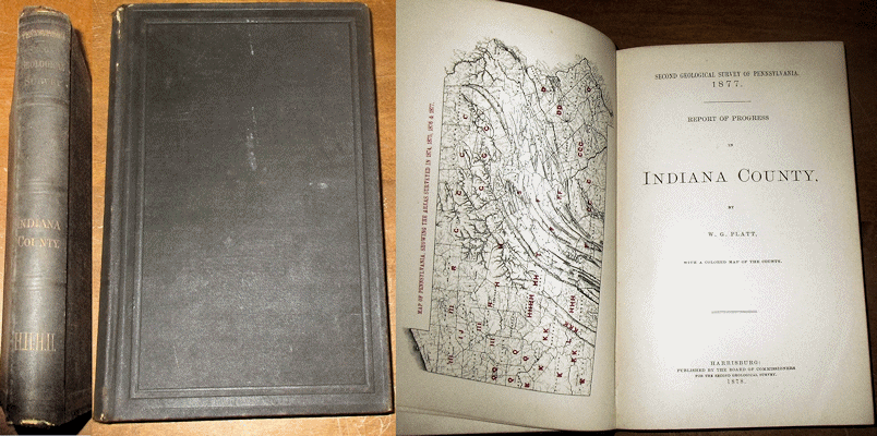
Platt W. G. 1878 REPORT OF PROGRESS IN INDIANA COUNTY Pennsylvania Geological Survey, 2nd Series, Volume HHHH 8vo in org. cloth, short nick to spine ends which are frayed, gilt spine title faded else vg copy, contents clean with 315 pp., 87 figs. + pocket map. Price: $35.00 (stock#PA2ndHHH)


Platt F. 1881 THE GEOLOGY OF BLAIR COUNTY Pennsylvania Geological Survey, 2nd Series, in original brown cloth as issued, gilt spine title faded per usual, minor split along gutter of spine/front cover else a very good copy, contents clean and unmarked with 311 pp., 35 figures and the accompanying Atlas which has the original slip case with a former owner's bookplate label, some wear, old library marking on the spine. The atlas contains 17 map and section sheets all of which are very good, clean and appear to have been seldom if ever perused. Scarce to find with the atlas intact, and complete.
Price: $80.00 (stock#PA2ndt1)

Postel A. W. 1952 GEOLOGY OF THE CLINTON COUNTY MAGNETITE DISTRICT NEW YORK U. S. Geological Survey Professional Paper #237 4to, in wraps as issued, some external wear, contents good with 88 pp., 3 plates (folding maps in rear pocket), 38 figures, on the geology of the Lyon Mountain region in northeastern New York State.
Price: $25.00 (stock#PP237)
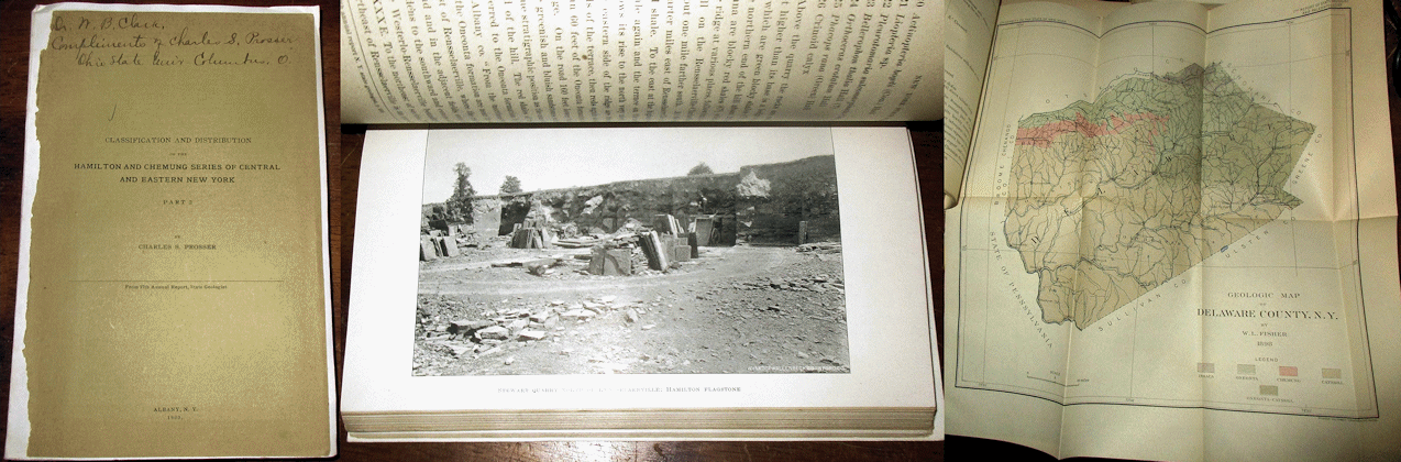
Prosser C. S. 1900 CLASSIFICATION AND DISTRIBUTION OF THE HAMILTON AND CHEMUNG SERIES OF CENTRAL AND EASTERN NEW YORK PART 2 from 17th Annual Report of the State Geologist, original front wrap pasted onto archival wrap with author's presentation on front wrap to W. B. Clark, who was the State Geologist of Maryland at the time. Contents good with 286 pp., a score of figures, plates, and a few maps and fold outs, and one of the classic publications on the stratigraphy and paleontology of the Middle Devonian of central and eastern New York State, and signed by the author. Price: $35.00 (stock#NY29)

Reed J. C. 1934 GEOLOGY OF THE POTSDAM QUADRANGLE New York State Museum Bulletin #297 wraps with ugly
stamp else contents very good with 98 pp., 55 figures, folding map in rear pocket, focused on this region of northeastern New York State and the type area for the Potsdam Series of the historical literature, with discussion of mineral resources. Price: $25.00 (stock#NYSMB297)
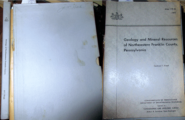
Root S. I. 1971 GEOLOGY AND MINERAL RESOURCES OF NORTHEASTERN FRANKLIN COUNTY, PENNSYLVANIA Pennsylvania Geological Survey, 4th Series, Atlas #119-A-B, light wear, ex-lib else very good set with 104 pp., 2 plates and large folding geologic map. Price: $25.00 (stock#PAGSA119A-B)
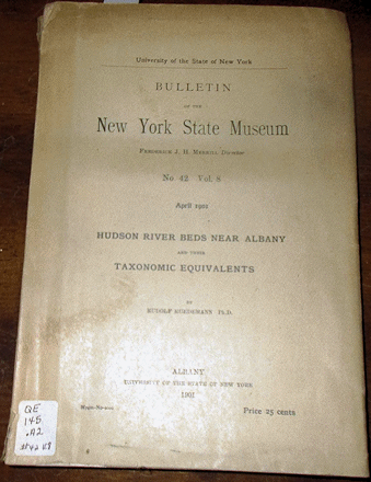
Ruedemann R. 1901 HUDSON RIVER BEDS NEAR ALBANY AND THEIR TAXONOMIC EQUIVALENTS New York State Museum Bulletin #42 8vo, some external wear, ex-lib copy, contents good with 112 pp., 2 plts, map.
Price: $25.00 (stock#NYSMB42)
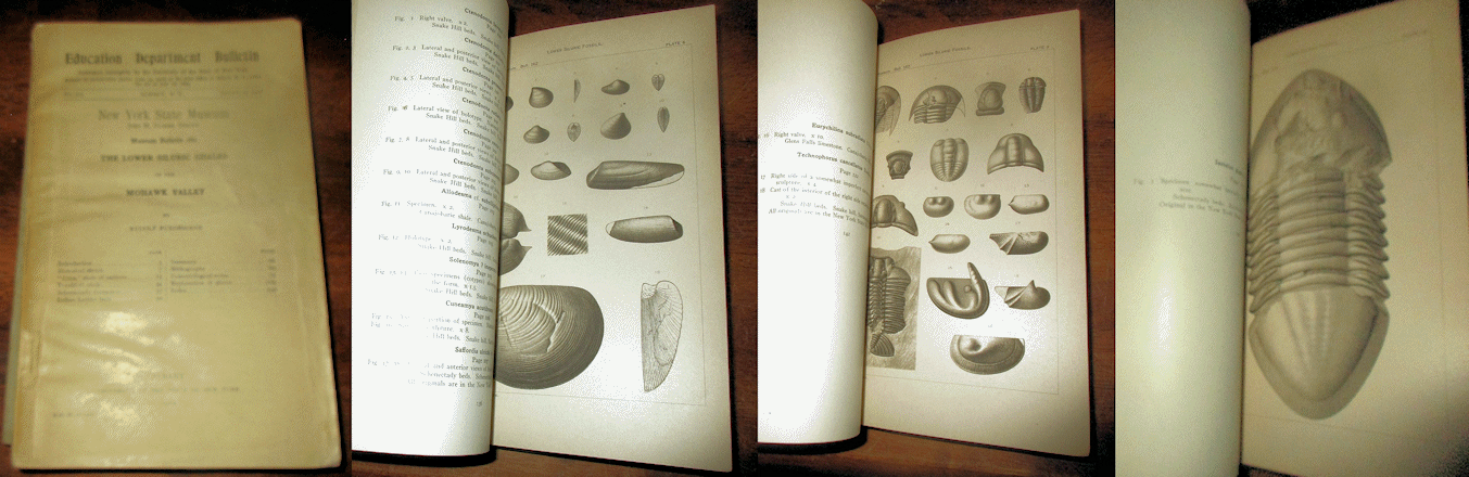
Ruedemann R. 1912 LOWER SILURIC SHALES OF THE MOHAWK VALLEY New York State Museum Bulletin #162 8vo, in wraps as issued, some external wear, contents good with 151 pp., 10 plates, 30 figures, and focused on the Ordovician and Silurian age shale-dominated formations just east of Albany, which are loaded with fossil trilobites, graptolites, occasional eurypterids, cephalopods, and more. Price: $30.00 (stock#NYSMB162)

Ruedemann R. 1916 PALEONTOLOGIC CONTRIBUTIONS FROM THE NEW YORK STATE MUSEUM New York State Museum Bulletin #189 8vo, in wraps as issued, wraps with corner tears, chips to margins and spine paper, mm area of page corners at first few pages, some wear overall, contents otherwise good with 225 pp., 36 plates, and 46 figures. Contents are diverse and cover fossil crinoids, starfish, trilobites and other critters that roamed the lower Paleozoic seas of New York State. Scarce. Price: $35.00 (stock#NYSMB189)

Salisbury R. D. and G. N. Knapp G. N. 1917 QUATERNARY FORMATIONS OF SOUTHERN NEW JERSEY Final Report Of
The State Geologist, New Jersey Geological Survey, Volume 8. In cloth as issued, some external wear, former ownership stamp on free end paper else contents good with 218 pp., 55 figs. Price: $40.00 (stock#NJFR08)

Shaffner M. N. 1958 GEOLOGY AND MINERAL RESOURCES OF THE NEW FLORENCE QUADRANGLE PENNSYLVANIA
Pennsylvania Geological Survey Atlas Series #57 8vo, some external wear, contents with oil company stamp to title page else good with 128 pp., 13 plates including folding maps and charts in front pocket, 16 figures that detail the geology of this region of southwestern Pennsylvania. Price: $35.00 (stock#PAGSA57)

Sherwood E. et al. 1878 REPORT OF PROGRESS IN BRADFORD AND TIOGA COUNTIES Geol. Surv. PA, 2nd Series, Volume G 8vo, original cloth with external wear, gilt spine title faded, contents vg with frontis map, 271 pp., figs, and 2 large folding pocket maps. Price: $45.00 (stock#PA2ndvolG)
Sherwood W. C. 1964 STRUCTURE OF THE JACKSONBURG FORMATION IN NORTHAMPTON AND LEHIGH COUNTIES PENNSYLVANIA PAGS Bull. G-45, 8vo, ex-lib, vg, 64 pp., 1 plt, map. Price: $20.00 (stock#PAGSG45)

Smith R. C. II 1977 ZINC AND LEAD OCCURRENCES IN PENNSYLVANIA Pennsylvania Geological Survey, 4th Series, Mineral Resource Report #72, 8vo, thick text and map slip case. With 318 pp., 8 folding maps and charts, and 108 figs.
Price: $30.00 (stock#PAGSMR72)

Smith W. G. and Bebbett F. Jr. 1901 LEBANON PENNSYLVANIA USDA soil survey map, folding colored map, measuring approx. 48 x 60 inches, short closed tear to blank margin (no paper loss) else vg condition.
Price: $25.00 (stock#PAsoilsLebanon)

Smock J. C. 1891 ANNUAL REPORT OF THE STATE GEOLOGIST FOR THE YEAR 1890 8vo, in cloth as issued, some external wear, contents good with 305 pp., numerous illustrations including a folding colored map and black and white cross section sheet (bound in) of the Franklin Furnace Limestone region of Sussex County which accompany a report on the area by Nason, large folding maps of New Jersey Watersheds and Principal Iron Mines loosely inserted at rear, and other diverse contents which include a comprehensive report on New Jersey Iron Mines, extended chapter on water resources, and more. Scarce to find with the maps present. Price: $40.00 (stock#NJAR90)
Smock J. C. 1892 ANNUAL REPORT OF THE STATE GEOLOGIST FOR THE YEAR 1892 original stiff wraps as issued, some wear overall, title page a bit darkened else rest of volume good with 367 pp., 9 plates, 9 figures, and two large folding maps in the rear pocket. Most of the volume focuses on the Cretaceous through Tertiary Coastal Plain strata and fossils with other reports on water resources, glacial deposits, and more. The two large folding maps are in vg condition. Scarce to find with the maps present. Price: $35.00 (stock#NJAR92)

Smock J. C. 1895 ANNUAL REPORT OF THE STATE GEOLOGIST FOR THE YEAR 1894 8vo, in original stiff wraps as issued, some external wear, contents good with 303 pp., 11 plates, 1 figure, AND ALSO INCLUDES the seldom seen, large folding colored map GEOLOGICAL MAP OF THE VALLEY OF THE PASSAIC which was issued in a separate folder and is included here. Contents of the volume cover numerous topics and include much on the glacial deposits in the northern part of the State, Artesian water and wells, and more. Scarce, and NEVER found with the accompanying large folding map. Price: $80.00 (stock#NJAR94)
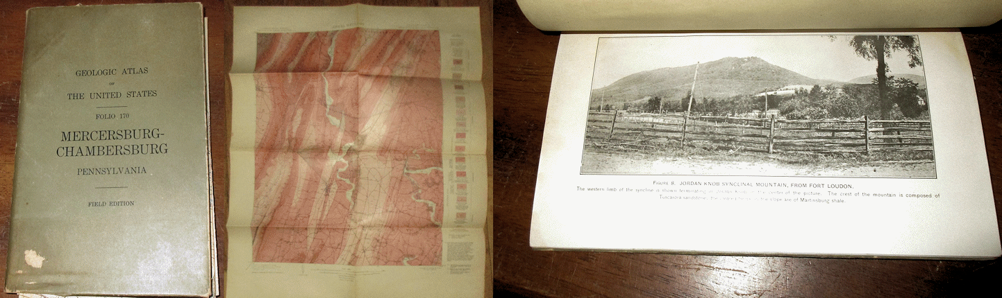
Stose G. W. 1910 GEOLOGIC ATLAS OF THE UNITED STATES - MERCERSBURG - CHAMBERSBURG FOLIO U. S. Geological Survey Atlas Folio #170, field edition, 8vo, in wraps as issued, some wear, a few smudges and faded stamps on title page else contents good with 144 pp., 18 figs and the six (6) large folding topographic and geologic maps inside the front pocket. Hard to find as the field edition issue. Price: $35.00 (stock#AF170FE)
Stose G. W. 1932 GEOLOGY AND MINERAL RESOURCES OF ADAMS COUNTY PENNSYLVANIA PA Geol. Survey County Atlas Series C1, Part 1 wraps with short tears, some wear overall, short tears to large folding colored county bedrock map, overall good copy with 153 pp., 26 plts. Price: $30.00 (stock#PAGSC1)

Stose G. W. and Jonas A. I. 1939 GEOLOGY AND MINERAL RESOURCES OF YORK COUNTY PENNSYLVANIA Pennsylvania Geological Survey Bulletin C-67 8vo, in stiff wraps as issued, ex-lib with notation to front wrap, stamp to title page else contents good and overall a very good copy with 199 pp., 38 plts, 14 figs including the large folding colored geologic map in the rear pocket. Scarce to find with the map present. Price: $45.00 (stock#PAYk)

White I. C. 1878 THE GEOLOGY OF LAWRENCE COUNTY TO WHICH IS APPENDED A SPECIAL REPORT ON THE CORRELATION OF THE COAL MEASURES OF WESTERN PENNSYLVANIA AND EASTERN OHIO Pennsylvania Geological Survey 2nd Series, Volume QQ 8vo, in brown cloth as issued, gilt spine title a bit faded per usual, contents good and a clean, unmarked copy (no stamps or signatures), 336 pp., 134 figs. and large folding map in rear pocket. Scarce.
Price: $45.00 (stock#PAqq)

Willard B. 1938 A PALEOZOIC SECTION AT DELAWARE WATER GAP Pennsylvania Geological Survey Bulletin G-11 8vo, in wraps as issued, ex-lib else good copy, 35 pp., 9 figs that describe the Ordovician (Martinsburg Formation) through Devonian section and its fossils. Price: $20.00 (stock#PAGSBG-11)
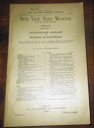
Woodworth J.B. 1905 PLEISTOCENE GEOLOGY OF THE MOOERS QUADRANGLE BEING A PORTION OF CLINTON COUNTY New York State Museum Bulletin #83 8vo, in wraps as issued, some external wear, contents good with 60 pp., 25 plts, 1 map in rear pocket. Located just west of Lake Champlain in the vicinity of Beekmantown. Scarce.
Price: $30.00 (stock#NYSMB83)
OREGON WASHINGTON
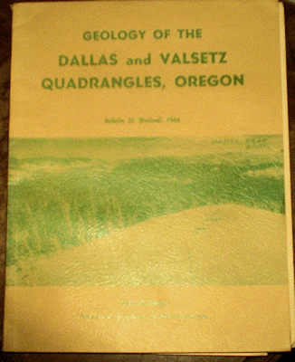
Baldwin E. M. 1964 GEOLOGY OF THE DALLAS AND VALSETZ QUADRANGLES OREGON OR Geol. Surv. Bull. 35 (2nd ed.) wraps light wear, contents vg, 56 pp., 14 figs, 1 plate (pocket map). Price: $30.00 (stock#ORGSB35)

Bancroft H. and Lindgren W. 1914 THE ORE DEPOSITS OF NORTHEASTERN WASHINGTON INCLUDING A SECTION ON THE REPUBLIC MINING DISTRICT wps, ex-lib, chips to paper spine ends, contents vg, 215 pp 19 plts 26 figs.
Price: $35.00 (stock#USGSB550)

Becraft G. E. and Weis P. L. 1963 GEOLOGY AND MINERAL DEPOSITS OF THE TURTLE LAKE QUADRANGLE WASHINGTON U. S. Geological Survey Bulletin #1131 wraps, corner bump, ex-lib with stamps else contents very good with 73 pp., 6 plates and 10 figures and good coverage of the O-Lo-Lim Copper Mine, Orazada , Valley View , Fouress (4-8) Zinc Mines and Matherly Prospect; the Germania Consolidated Tungsten Mine and more, and with nice maps.
Price: $20.00 (stock#USGSB1131)
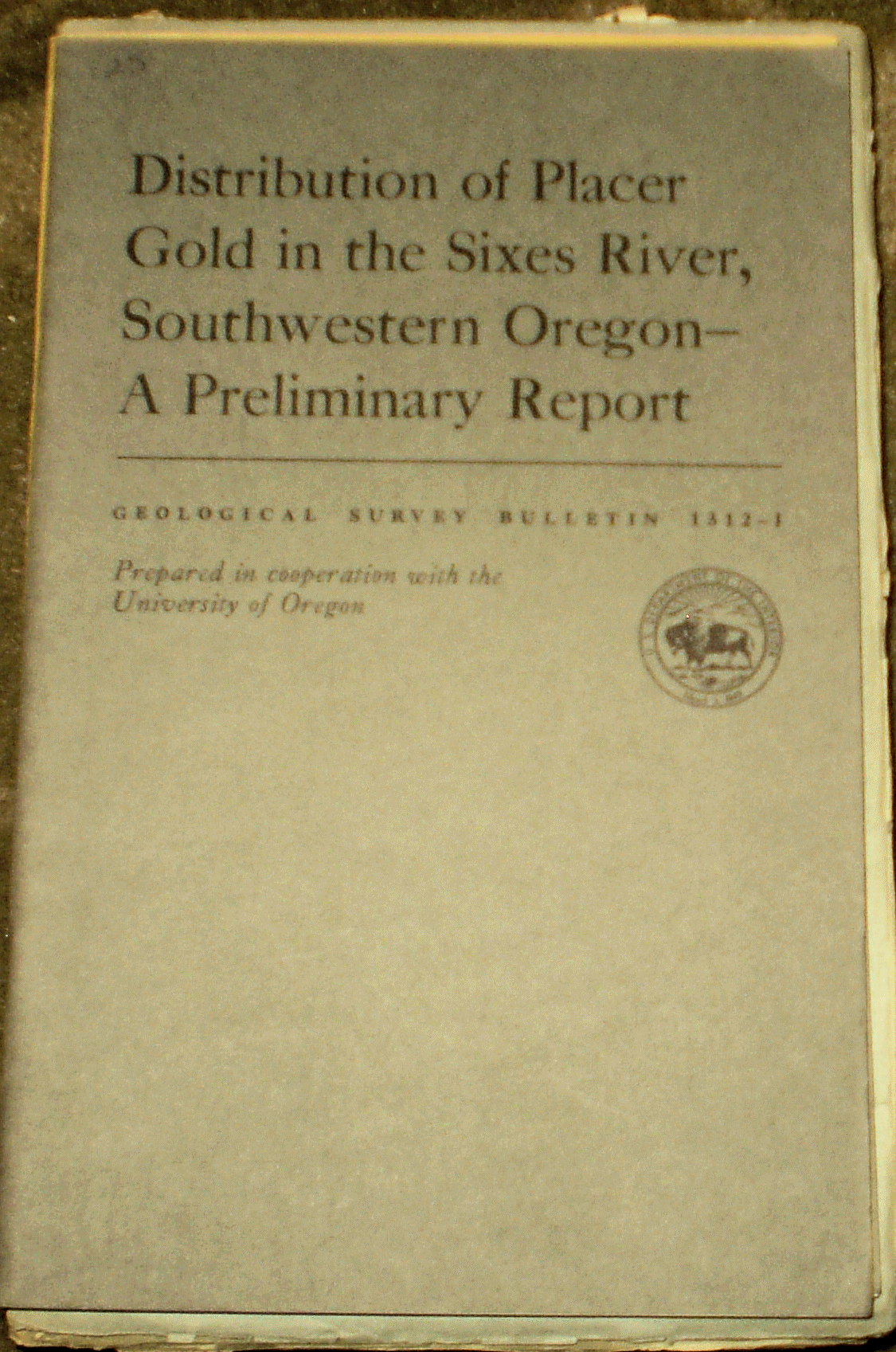
Boggs S. and Baldwin E. M. 1970 DISTRIBUTION OF PLACER GOLD IN THE SIXES RIVER, SOUTHWESTERN OREGON, A PRELIMINARY REPORT USGS Bull. #1312-I wps light wear vg 27 pp., 9 figs. Price: $15.00 (stock#USGSB1312Ir)

Brown R. E. and Waters A. C. 1951 QUICKSILVER DEPOSITS OF THE BONANZA-NONPAREIL DISTRICT, DOUGLAS COUNTY, OREGON U. S. Geological Survey Bulletin #955-F, 8vo, in wraps as issued, some external wear, contents good with 26 pp., 10 plts, 4 figs on the mining district located just north of Roseburg in western Oregon.
Price: $20.00 (stock#USGSB955F)
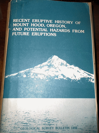
Crandall D. R. 1980 RECENT ERUPTIVE HISTORY OF MOUNT HOOD OREGON AND POTENTIAL HAZARDS FROM FUTURE ERUPTIONS U. S. Geological Survey Bulletin #1492 in wraps as issued, some external wear, contents good, 81 pp., 1 plt, 20 figs and frontis plate. Price: $15.00 (stock#USGSB1492)
Crandell D. W. and Miller R. D. 1974 QUATERNARY STRATIGRAPHY AND EXTENT OF GLACIATION IN THE MOUNT RAINER REGION WASHINGTON U. S. Geological Survey Professional Paper #847 4to, in wraps as issued, some wear, contents good with 59 pp., 2 plates, 42 figures, and a important reference loaded with data in light of the recent trend of ice glacier shrinkage and volumes in light of global warming trends. Price: $20.00 (stock#PP847wa)

Culver H. E. 1936 THE GEOLOGY OF WASHINGTON PART 1 - GENERAL FEATURES OF WASHINGTON GEOLOGY Washington Geological Survey Bulletin #32 8vo, in wraps as issued, old notation on wrap, some wear, contents good
with 67 pp. Scarce. Price: $20.00 (stock#WAGSB32)
Culver H. E. and Broughton W. A. 1945 TUNGSTEN RESOURCES OF WASHINGTON Washington Geological Survey Bull. #34 8vo, in wraps as issued, some external wear, contents good with 89 pp., 23 plts, 9 figs including folding map in rear pocket. Price: $20.00 (stock#WAGSB34)
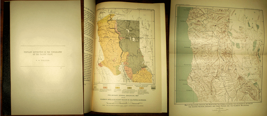
Diller J. S. 1893 TERTIARY REVOLUTION IN THE TOPOGRAPHY OF THE PACIFIC COAST from U. S. Geological Survey
14th Ann. Rpt., spine taped else light wear, contents vg, 38 pp., 8 plts, 4 figs. Price: $25.00 (stock#OR32)
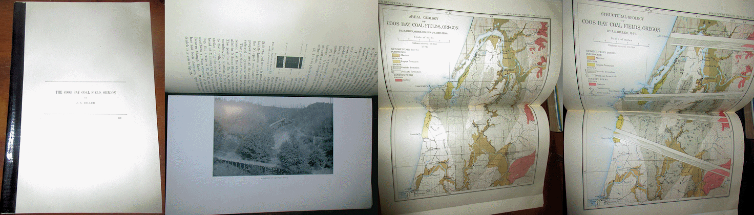
Diller, J. S. 1899 THE COOS BAY COAL FIELD, OREGON from 19th Annual Report of the U. S. Geological Survey, 4to, spine with archival tape else light wear, very good and clean copy with 65 pp., 13 plates, 63 figures and with good measured section and locality information, as well as great historical mining photos. An important reference on the geology of the Coos Bay region. Price: $25.00 (stock#OR29)
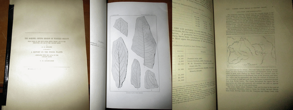
Diller J. S. 1900 THE BOHEMIA MINING REGION OF WESTERN OREGON WITH NOTES ON THE BLUE RIVER MINING REGION AND ON THE STRUCTURE AND AGE OF THE CASCADE RANGE, ALSO A REPORT ON THE FOSSIL PLANTS ASSOCIATED WITH THE LAVAS OF THE CASCADE RANGE By Knowlton, F. H. 1900 from U. S. Geological Survey 20th Annual Rpt, 4to, spine with tape else very good copy with 56 pp., 6 plates, 3 figures that cover the geology of this Oregon gold mining region and adjacent areas. Price: $30.00 (stock#OR26)
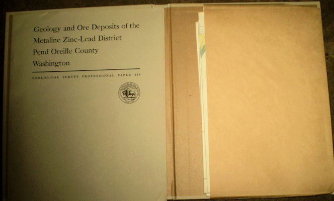
Dings M. G. and Whitebread D. H. 1965 GEOLOGY AND ORE DEPOSITS OF THE METALINE ZINC LEAD DISTRICT PEND OREILLE COUNTY WASHINGTON USGS Prof. Paper #489 text with map slip case, small smudge to case else light wear, vg, 109 pp., 6 plts 39 figs. Price: $30.00 (stock#PP489)

Griffen W. C. et al. 1962 WATER RESOURCES OF THE TACOMA AREA WASHINGTON U. S. Geological Survey Water Supply Paper #1499-B 8vo, in wraps as issued, discrete museum stamp to front wrap, contents good with 101 pp., 4 plts, and 34 figs. Price: $15.00 (stock#WAwsp1499b)

Gresens R. L. 1983 GEOLOGY OF THE WENATCHEE AND MONITOR QUADRANGLES, CHELAN AND DOUGLAS COUNTIES WASHINGTON 4to, WA Geol. Surv. Bull. #75 wps, ex-lib, vg, 75 pp., 3 plts.
Price: $25.00 (stock#WAGSB75)

Hampton E. R. 1972 GEOLOGY AND GROUND WATER OF THE MOLALLA-SALEM SLOPE AREA NORTHERN WILLAMETTE VALLEY OREGON U. S. Geological Survey Water Supply Paper #1997 wraps and slip case of maps, light
wear, ex-lib. else overall very good with 79 pp., 2 plates (large folding maps in slip case), 15 figures.
Price: $20.00 (stock#WSP1997or)

Oregon Gold Mining, three (3) Reports, in Hayes C. W. and Lindgren W. (eds) 1909 CONTRIBUTIONS TO ECONOMIC GEOLOGY 1908 PART 1- METALS AND NON METALS EXCEPT FUELS U. S. Geological Survey Bulletin #380, 8vo, wraps with stamp, short tears to ends of paper spine else contents vg with 406 pp., 2 plts, and 32 figs. Gold silver and other precious metal mining contents include: NOTES ON THE ECONOMIC GEOLOGY OF SOUTHEASTERN GUNNISON COUNTY COLORADO By Hill, J. M.; MINERAL RESOURCES OF GRANTS PASS QUADRANGLE AND BORDERING DISTRICTS, OREGON By J. S. Diller and G. F. Kay; NOTES ON THE BOHEMIA MINING DISTRICT, OREGON By D. F. MacDonald; FAULTING AND VEIN STRUCTURE IN THE CRACKER CREEK GOLD DISTRICT, BAKER COUNTY OREGON By J. T. Pardee; THE TRES HERMANAS MINING DISTRICT NEW MEXICO By Lindgren, and more. Price: $45.00 (stock#USGSB380)

Hobbs S. W. and Pecora W. T. 1941 NICKEL-GOLD DEPOSITS NEAR MOUNT VERNON, SKAGIT COUNTY WASHINGTON USGS Bull. #931-D wps light wear vg 21 pp., 2 plts, 2 figs. Price: $20.00 (stock#USGSB931D)
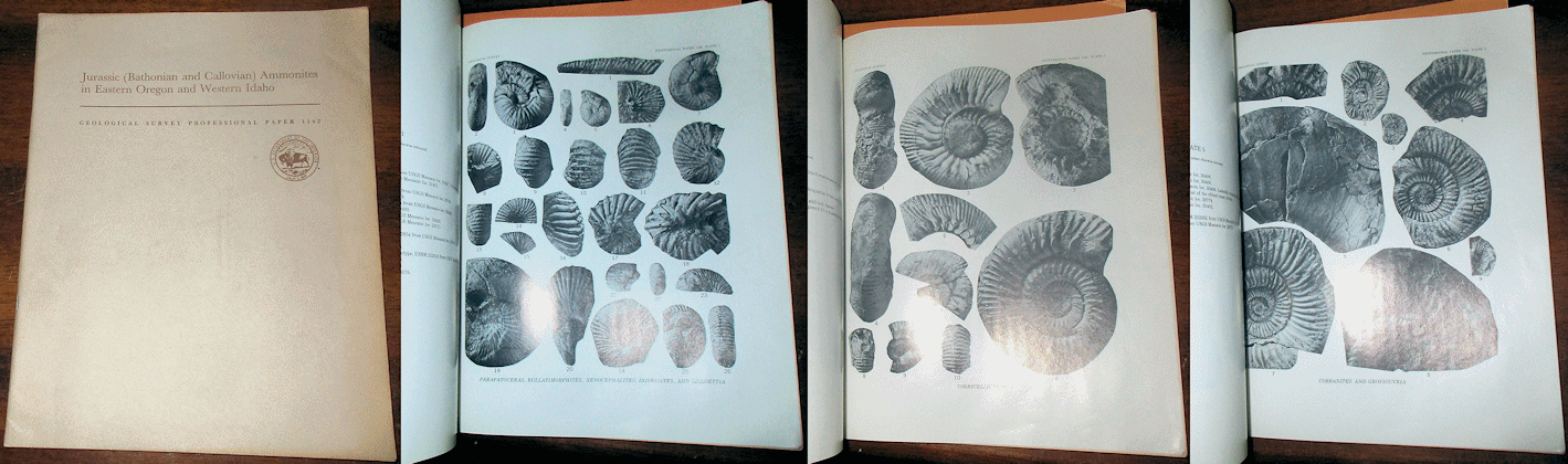
Imlay R. W. 1981 JURASSIC (BATHONIAN AND CALLOVIAN) AMMONITES IN EASTERN OREGON AND WESTERN IDAHO U. S. Geological Survey Professional Paper #1142 4to, in wraps as issued, some external wear, contents good with 24 pp., 5 plates of fossil ammonites, 4 figs. Price: $15.00 (stock#PP1142)

Lamy C. A. and Hotz P. E. 1952 THE CLE ELUM RIVER NICKELIFEROUS IRON DEPOSITS KITTITAS COUNTY, WASHINGTON USGS Bull. #978-B 8vo, wraps with stamp, some wear, contents good, 41 pp., 2 plts (folding pocket maps), 18 figs. Price: $15.00 (stock#USGSB978B)
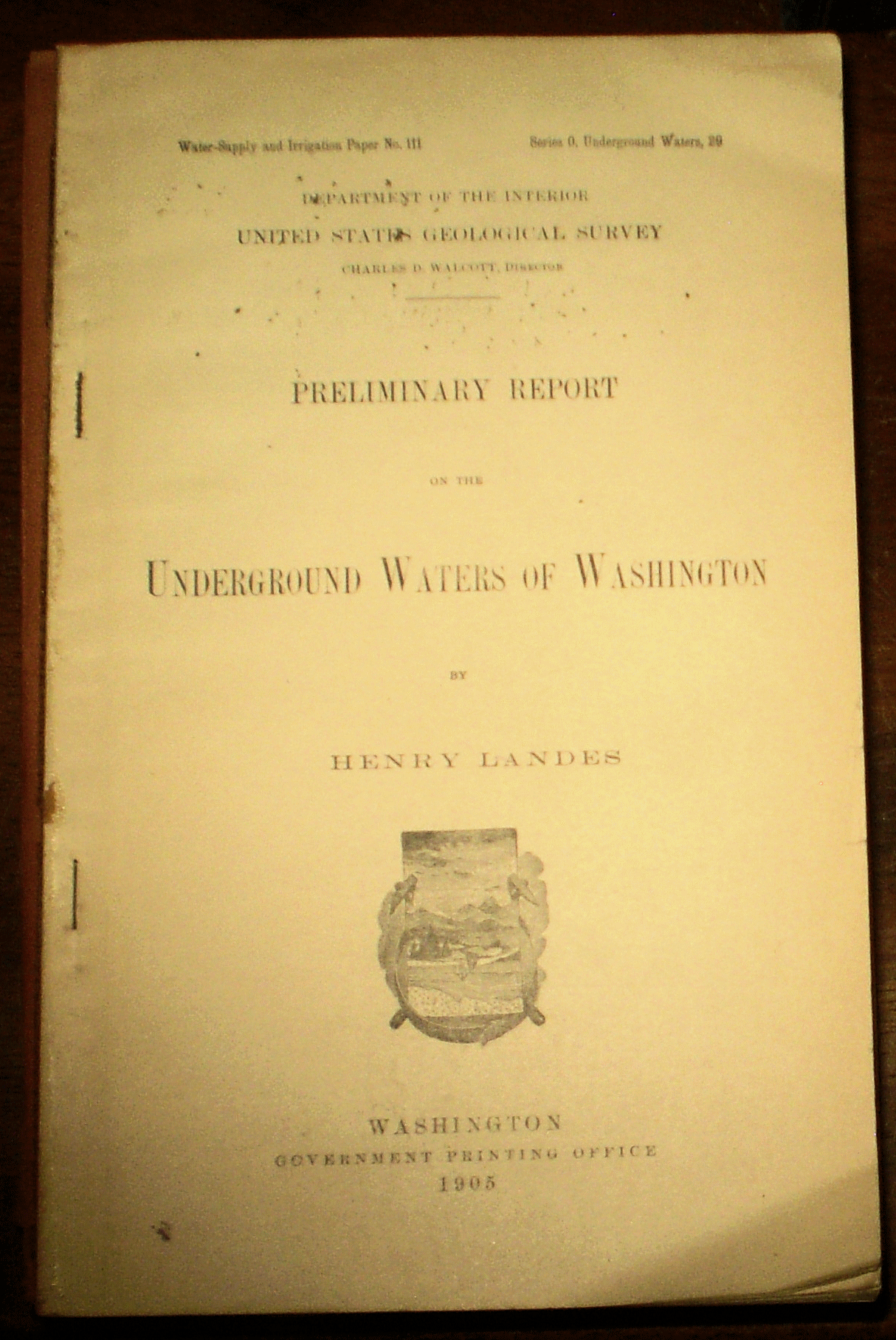
Landes H. 1905 PRELIMINARY REPORT ON THE UNDERGROUND WATERS OF WASHINGTON USGS Water Supply Paper #111 no wps, ex-lib, some wear, contents good, 85 pp., 1 plt. Price: $20.00 (stock#WSP111)
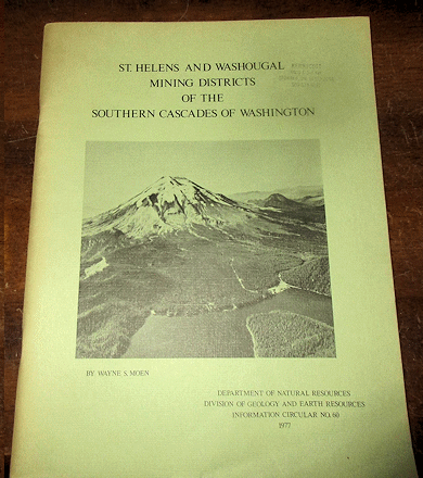
Moen W. S. 1977 ST. HELENS AND WASHOUGAL MINING DISTRICTS OF THE SOUTHERN CASCADES OF WASHINGTON
Washington Division of Geology and Earth Resources, Circular #60 4to, in wraps as issued, wraps with faded stamp, some wear, contents good with 71 pp., 26 figures on the geology and ore deposits of these mining districts which produce gold silver copper and other metals. Price: $25.00 (stock#WAGSCir60)

OREGON GEOLOGY PALEONTOLOGY. Two (2) reports on the John Day Fossil Beds, both published as part of the University of California, Publications in Geological Sciences series, both in wraps as issued, some external wear, bump to inner corner and stamp to one volume, the other with light wear, contents of both very good. They are: (1) Fisher R. V. and Rensberger J. M.1972 PHYSICAL STRATIGRAPHY OF THE JOHN DAY FORMATION CENTRAL OREGON with 33 pp., 9 plates, 8 figures; and (2) Fisher R. V. 1968 PYROGENIC MINERAL STABILITY, LOWER MEMBER OF THE JOHN DAY FORMATION, EASTERN OREGON with 36 pp., 1 plate. A nice set of reports on the fossil rich John Day beds.
Price: $25.00 (stock#OR24)

Parks C. F. Jr. 1941 MANGANESE RESOURCES OF THE OLYMPIC PENINSULA, WASHINGTON, A PRELIMINARY REPORT USGS Bull. #931-R wps, light wear, vg, 23 pp., plt, figs. Price: $15.00 (stock#USGSB931R)

Peck D. L. 1964 GEOLOGIC RECONNAISSANCE OF THE ANTELOPE-ASHWOOD AREA NORTH-CENTRAL OREGON USGS Bull. #1161-D wraps with sunned margin else light wear vg 26 pp., 1 plt (folding pocket map), 8 figs.
Price: $15.00 (stock#USGSB1161D)

Purdy C. P. Jr. 1951 ANTIMONY OCCURRENCES OF WASHINGTON 8vo, wps, light wear, ex-lib, vg, 186 pp., 14 figs. Price: $20.00 (stock#WAGSB039)
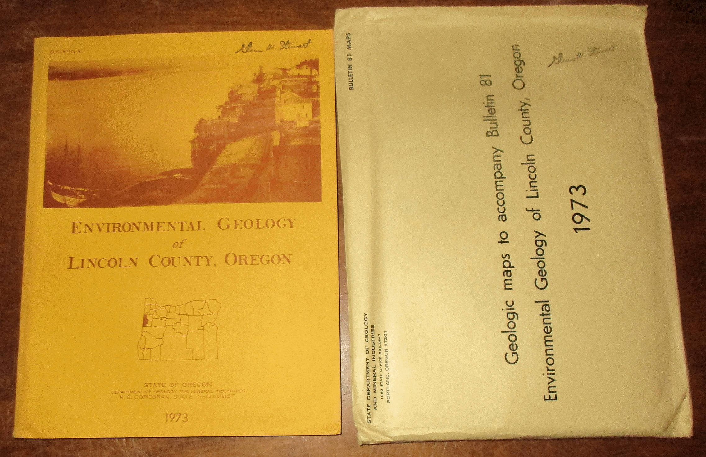
Schlicker H. G. et al. 1973 ENVIRONMENTAL GEOLOGY OF LINCOLN COUNTY OREGON Oregon Geological Survey Bulletin #81 4to in wraps with former owner's name stamp, small bump to lower inner corner else contents with light wear, 171 pp., 94 photos, 21 figures, and the packet of large folding maps. Price: $25.00 (stock#ORGSB81)

Shenon P. J. 1933 GEOLOGY OF THE ROBERTSON, HUMDINGER, AND ROBERT E. GOLD MINES SOUTHWESTERN OREGON with 34 pp., 12 plates, 3 figures, AND Gilluly J. COPPER DEPOSITS NEAR KEATING, OREGON with 32 pp., 2 plates, 1 figure. Both reports are contained in U. S. Geological Survey Bulletin #830, and is the complete volume. The bulletin is in original wraps as issued, some external wear, contents good. Price: $30.00 (stock#USGSB830)
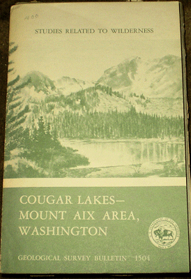
Simmons G. C. et al. 1983 MINERAL RESOURCES OF THE COUGAR LAKES-MOUNT AIX AREA WASHINGTON USGS Bull. #1504 wps light wear vg, 81 pp., 3 plts, 2 figs. with account of all known historic and potential gold silver and other economic mines and mineral deposits. Price: $15.00 (stock#USGSB1504r)

Snavley P. D. et al. 1958 GEOLOGY AND COAL RESOURCES OF THE CENTRALIA-CHEHALIS DISTRICT, WASHINGTON, WITH A SECTION ON MICROSCOPICAL CHARACTER OF THE CENTRALIA-CHEHALIS COAL U. S. Geological Survey Bulletin #1053 8vo, in wraps, small label, some wear, short tears to wraps, contents good with 159 pp., 9 plts, 25 figs including the large folding geologic map of the region. Price: $20.00 (stock#USGSB1053)

Staatz M. H. 1964 GEOLOGY OF THE BALD KNOB QUADRANGLE FERRY AND OKANOGAN COUNTIES, WASHINGTON USGS Bull. #1161-F wps, light wear, vg, 79 pp., 1 plt, figs. Price: $20.00 (stock#USGSB1161F)

Stevens J. C. 1910 WATER POWERS OF THE CASCADE RANGE; PART 1, SOUTHERN WASHINGTON bound in USGS tan buckrum covers from which other water supply papers were removed, contents vg with 94 pp., 21 plates, 3 figs. Of the plates, 12 are folding maps of river profiles. Aside from being useful to hydrologists, the profile maps show the river course, meanders and bends as they were over 100 years ago, and are useful in prospecting for heavy minerals (such as gold). Price: $35.00 (stock#WS253)

U. S. Geological Survey 1989 GEOLOGICAL, GEOPHYSICAL AND TECTONIC SETTING OF THE CASCADE RANGE U. S. Geol. Surv. Open File Report 89-178 4to, in wraps as issued, small stamp to wrap, some external wear, contents vg with 706 pp., numerous figures and provides a nice selection of different topics regarding geology of the Cascade Mountains. Scarce to find a printed copy. Price: $40.00 (stock#WA54)
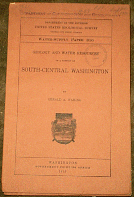
Waring G. S. 1913 GEOLOGY AND WATER RESOURCES OF A PORTION OF SOUTH-CENTRAL WASHINGTON USGS Water Supply Paper #316 wps with some wear, ex-lib, contents vg, 46 pp., 1 plt, 1 fig.
Price: $20.00 (stock#WSP316)
Weissenborn A. E. 1970 LEAD ZINC DEPOSITS IN THE KOOTENAY ARC NORTHEASTERN WASHINGTON AND ADJACENT BRITISH COLUMBIA Washington Geological Survey Bulletin #61 4to, in wraps as issued, light wear, contents good with 123 pp., a score of figures and the volume contains contributed papers that cover the geology and ore deposits of this region of the Pacific Northwest. Price: $30.00 (stock#WAGSB61)
Wilkinson W. D. et al. 1946 GEOLOGY OF THE ST. HELENS QUADRANGLE OREGON OR Geol. Surv. Bull. #31 4to, wps, ex-lib, vg, 39 pp., 3 figs, map. Price: $30.00 (stock#ORGSB31)

Willis B. 1898 SOME COAL FIELDS OF PUGET SOUND from 18th USGS Ann Rpt. cloth tape on spine, light wear, vg, 43 pp., 15 plts, 6 figs including the 2 folding pocket maps which are loosely inserted. With great period photos and many measured sections, with good locality data. Price: $25.00 (stock#OR31)
Yates R. G. 1942 QUICKSILVER DEPOSITS OF THE OPALITE DISTRICT, MALHEUR COUNTY, OREGON, AND HUMBOLDT COUNTY, NEVADA USGS Bull. #931-N wps light wear ex-lib, contents vg, 30 pp., 7 plts (1 pocket map), 3 figs. Price: $15.00 (stock#USGSB931N)
NEBRASKA NORTH DAKOTA SOUTH DAKOTA WYOMING
Akin P. D. 1947 GEOLOGY AND GROUND WATER CONDITIONS AT MINOT NORTH DAKOTA North Dakota Geological Survey, Ground Water Series - No. 6 4to, in stiff wraps, some external wear, contents good with 99 pp., 12 figures including charts in rear pocket. Price: $25.00 (stock#ND05)

Bell H. and Bales W. E. 1955 URANIUM DEPOSITS IN FALL RIVER COUNTY SOUTH DAKOTA U. S. Geological Survey Bulletin #1009-G 8vo, in wraps as issued, some external wear, contents good with 21 pp., 5 plates, 6 figures and focused largely on the Lakota and Fall River Sandstones (Morrison and Dakota Formation rough equivalents) in the Black Hills region. Price: $20.00 (stock#USGSB1009G)
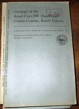
Braddock W. A. 1963 GEOLOGY OF THE JEWEL CAVE SW QUADRANGLE, CUSTER COUNTY, SOUTH DAKOTA U. S. Geological Survey Bulletin #1063-G 8vo, in wraps, ex-lib. copy with faded stamp, some wear, contents good with 51 pp., 14 figures and the 3 folding colored pocket maps/charts. Price: $20.00 (stock#USGSB1063G)

Calvert W. B. et al. 1914 GEOLOGY OF THE STANDING ROCK AND CHEYENNE RIVER INDIAN RESERVATIONS NORTH AND SOUTH DAKOTA no wraps, archival tape along spine, contents vg with 49 pp., 8 plts, 1 fig. One of the plates is a large fold out map loosely inserted, the other fold out bound into text. Price: $25.00 (stock#USGSB575)

Clapp C. H. and Babock E. J. 1906 CLAY AND ITS PROPERTIES WITH SPECIAL REFERENCE TO NORTH DAKOTA CLAYS in FOURTH BIENNIAL REPORT, NORTH DAKOTA GEOLOGICAL SURVEY 8vo, front wrap with some wear, rear wrap lacking, contents with light wear, vg, the bulk of which is covered by the above report. With 324 pp., 37 plts, map of Tertiary clays (map has closed tear). Price: $30.00 (stock#NDGSAR4)
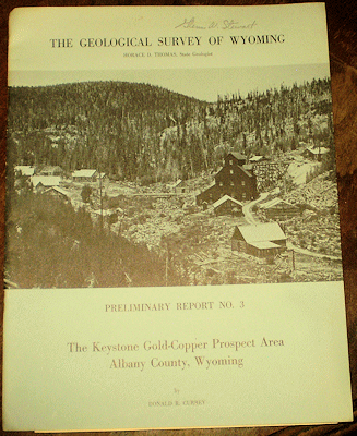
Currey D. R. 1965 THE KEYSTONE GOLD-COPPER PROSPECT AREA ALBANY COUNTY WYOMING WY Geol. Surv. Prelim. Rpt #3 4to, wps with signature else light wear, vg, 12 pp., 6 figs, folding map. Price: $20.00 (stock#WYGSPR03)
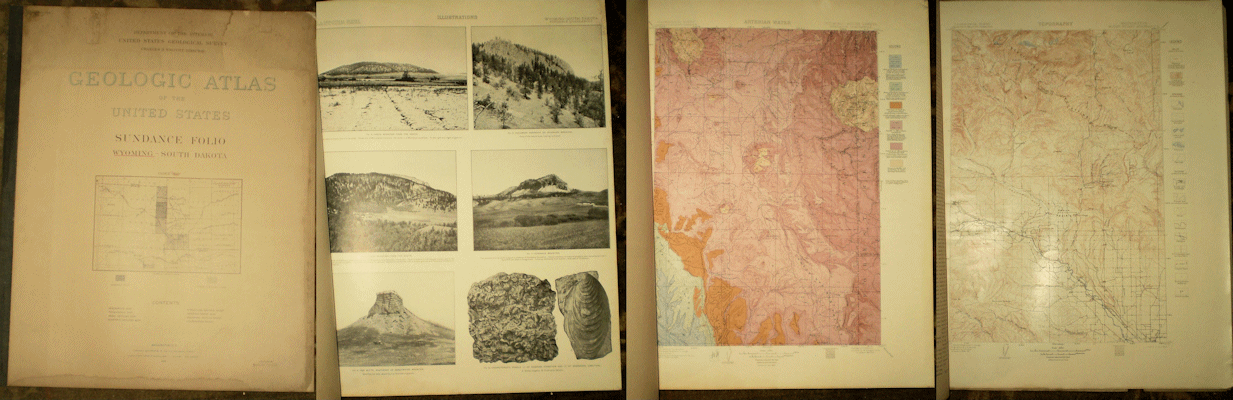
Darton N. H. 1905 SUNDANCE FOLIO WYOMING USGS Atlas Folio #127 wps/contents with marginal stain but mostly away from map borders, g-vg copy with 12 pp. Descriptive Text; Topographic Map; Areal Geologic Map; Economic Geology Map; Structural Geology Map; Artesian Water Supply Map; Columnar Section and Illustration Sheets.
Price: $35.00 (stock#AF127)

Darton N. H. & Seibenthal C. E. 1909 GEOLOGY AND MINERAL RESOURCES OF LARAMIE BASIN WYOMING USGS Bull. #364 wraps with stamp, notation else light wear, vg, 81 pp., 8 pls, 1 fig. and complete with the scarce map which usually has been removed. Price: $25.00 (stock#USGSB364)

Davis R. E. and Izett G. A. 1962 GEOLOGY AND URANIUM DEPOSITS OF THE STRAWBERRY HILL QUADRANGLE, CROOK COUNTY, WYOMING U. S. Geological Survey Bulletin #1127 wraps with some external wear, contents good with 87 pp., 6 plates including folding geologic map in rear pocket, and 8 figs. Price: $20.00 (stock#USGSB1127)

Field R. M. 1933 YELLOWSTONE - BEARTOOTH - BIG HORN REGION 16th International Geological Congress Guidebook #24 8vo, wraps with some wear, contents good with 64 pp., 14 figures, and descriptive travel logs across the field trip areas. Price: $30.00 (stock#WYIGC33)

Fisher C. A. 1906 GEOLOGY AND WATER RESOURCES OF THE BIGHORN BASIN WYOMING U. S. Geological Survey Professional Paper #53 4to, some external wear, front wrap loose with title page, rear wrap lacking, former owner's name to wrap and title page (a certain Ernest Robinson of Moore, Montana), contents good with 72 pp., 15 of 16 plates (the folding pocket map is lacking), 2 figs. Scarce. Price: $30.00 (stock#PP53)
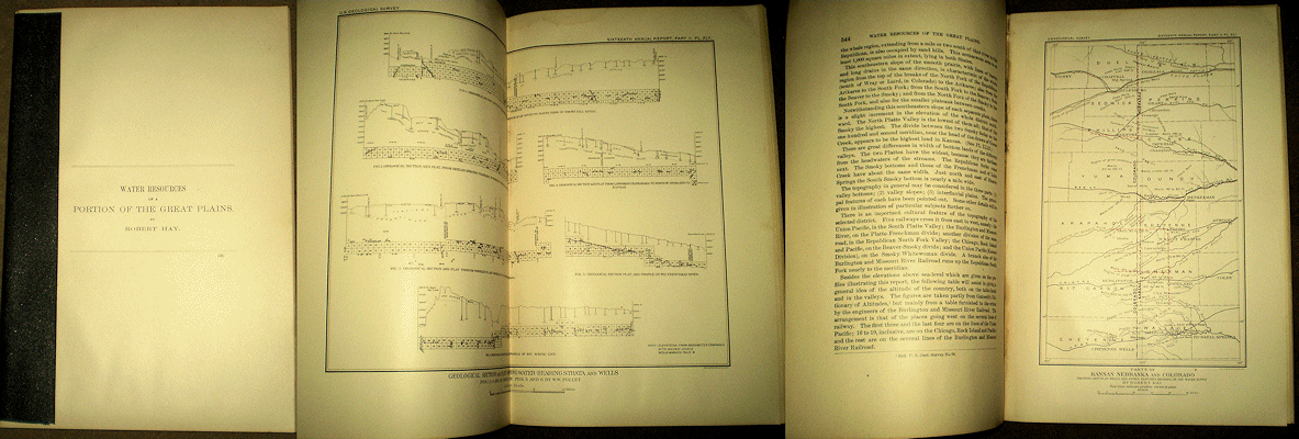
Hay R. 1895 WATER RESOURCES OF A PORTION OF THE GREAT PLAINS from 16th USGS Ann Rpt, no wps cloth tape on spine light wear vg, 53 pp., 4 plts, and 8 figs. Price: $20.00 (stock#NE14)

Hall C. M. and Willard D. E. 1905 CASSELTON – FARGO FOLIO NORTH DAKOTA – MINNESOTA USGS Atlas Folio #117 wps loose, some wear, short marginal tears, contents good, light soiling, maps good with 7 pp. text double page topographic maps double page areal geology maps and double page artesian water supply maps. Overall a fair copy only, and priced to reflect condition. Note shipping is $7.00 with item rolled. Price: $30.00 (stock#USGSAF117z)
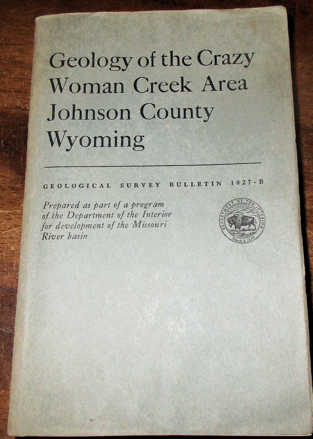
Hose R. K. 1955 GEOLOGY OF THE CRAZY WOMAN CREEK AREA, JOHNSON COUNTY, WYOMING U. S. Geol. Surv. Bulletin #1027-B wraps with some wear, contents good with 118 pp. 8 plates, 15 figs. on the geology of this part of the Powder River Basin, along the west flank of the Bighorn Mountains and much on the Cretaceous age strata of the region (and other units as well). Price: $20.00 (stock#USGSB1027B)

Houston R. S. eet al. 1968 A REGIONAL STUDY OF ROCKS OF PRECAMBRIAN AGE IN THAT PART OF THE MEDICINE BOW MOUNTAINS LYING IN SOUTHEASTERN WYOMING - WITH A CHAPTER ON THE RELATIONSHIP BETWEEN PRECAMBRIAN AND LARAMIDE STRUCTURE Wyoming Geological Survey Memoir #1 4to, text and map slip case complete, some external wear, contents and maps good with 167 pp., 35 plates, 63 figures.
Price: $30.00 (stock#WYGSM01)

Imlay R. W. 1967 TWIN CREEK LIMESTONE (JURASSIC) IN THE WESTERN INTERIOR OF THE UNITED STATES U. S.
Geological Survey Professional Paper #540 4to, in wraps as issued, stamp to wrap else contents good and a decent copy with 105 pp., 36 plates of fossils including many of fossil ammonites, 18 figs and on the middle Jurassic Twin Creek Fauna from Wyoming Idaho and Utah. A classic report by Imlay. Price: $25.00 (stock#PP540)
Jaggar T. A. 1901 THE LACCOLITHS OF THE BLACK HILLS from 21st U. S. Geological Survey Annual Rpt 4to, tape along spine else ight wear, contents very good with 135 pp., 29 plates, 43 figures. With nice plates that include colored maps and sections. Price: $30.00 (stock#SD32)

Keefer W. R. and Troyer M. L. 1964 GEOLOGY OF THE SHOTGUN BUTTE AREA FREMONT COUNTY WYOMING U. S. Geological Survey Bulletin #1157 8vo, in wraps as issued, ex-lib. else light wear, contents good with 123 pp., 3 plates including the large folding colored bedrock map, 16 figures. Price: $20.00 (stock#USGSB1157)
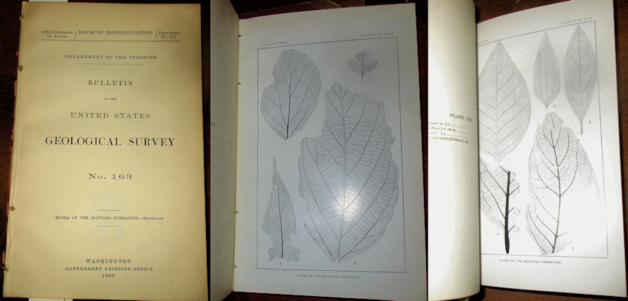
Knowlton F. H. 1900 FLORA OF THE MONTANA FORMATION U. S. Geololgical Survey Bulletin #163 8vo, no wraps, some external wear, contents good with 118 pp., 19 plates of fossil plants. On Cretaceous age fossil flora of Wyoming, Montana, Utah and nearby areas. Scarce. Price: $20.00 (stock#USGSB163)
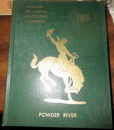
Laudon R. B. et al. 1976 POWDER RIVER Wyoming Geological Association Guidebook 4to, in gilt decorated cloth as issued, blind stamp to free end paper else contents vg with 328 pp., scores of figures and large folding maps and charts in rear pocket. Contents include papers on Cretaceous stratigraphy, sedimentology and paleontology, oil and gas reports, mining, regional structure and more. A nice volume. Price: $30.00 (stock#WY21)
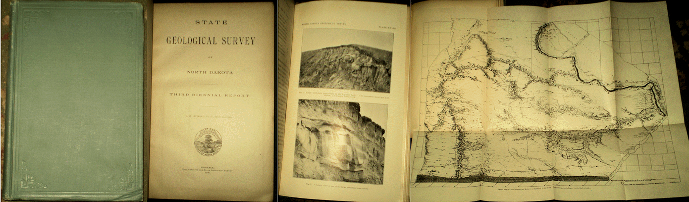
Leonard A. G. 1904 THIRD BIENNIAL REPORT North Dakota Geological Survey cloth, corner of front board bumped but text not affected, very good clean copy, 220 pp., 33 plts, 8 figs, 2 folding maps. Includes “THE GEOLOGICAL FORMATIONS OF NORTH DAKOTA” and other reports, much on the Fort Union Formation.
Price: $50.00 (stock#ND3rd)

Leonard A. G. 1906 FOURTH BIENNIAL REPORT North Dakota Geological Survey cloth with some external wear, corner of front board bumped but text not affected, contents very good. With 324 pp., 37 plts, folding map. The volume is devoted to the Clays of North Dakota, and as such, focuses on the Cretaceous and early Tertiary (Fort Union) beds. Price: $50.00 (stock#ND4th)
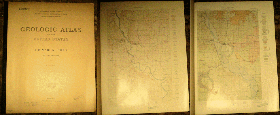
Leonard A. G. 1915 BISMARCK FOLIO, NORTH DAKOTA U. S. Geological Survey Atlas Folio #181 wps, light wear, contents very good with 8 pages of Descriptive Text, Topographic Map, and Areal Geology Map.
Price: $35.00 (stock#AF181)

Lugn A. L. 1935 THE PLEISTOCENE GEOLOGY OF NEBRASKA Nebraska Geological Survey Bulletin #10 8vo, in stiff wraps, some external wear, ex-lib, contents good with 223 pp., 2 plates (small folding maps bound in text), 38 figures.
Price: $30.00 (stock#NEGSB10)
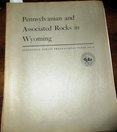
Mallory W. W. 1967 PENNSYLVANIAN AND ASSOCIATED ROCKS IN WYOMING U. S. Geological Survey Professional Paper #554-G 4to, in wraps as issued, wraps with some wear, contents good with 31 pp., 3 plates, 16 figures and includes good measured section and locality data. Price: $15.00 (stock#PP554G)
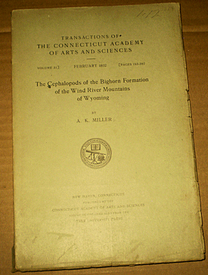
Miller A. K. 1932 THE CEPHALOPODS OF THE BIGHORN FORMATION OF THE WIND RIVER MOUNTAINS OF WYOMING CT Acad. Arts Sciences Vol. 31 wraps and lower corner of pages with some wear else contents vg, 105 pp., 31 plates, pages largely unopened. Price: $30.00 (stock#IPM138P)

Perisho E. C. 1908 SOUTH DAKOTA GEOLOGICAL SURVEY, REPORT OF THE STATE GEOLOGIST, 1908 8vo, in wraps as issued, some wear, contents good with 227 pp., 52 plates, 2 figures. With much on the geology and natural history of the Rosebud Reservation, a report on Cretaceous plants, Geology Of Central Northwestern South Dakota, and more. Scarce. Price: $45.00 (stock#SDAR08)
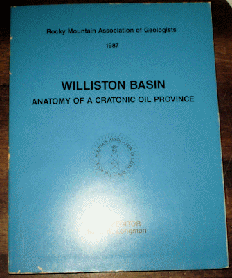
Peterson J. and Longman M. W. (eds.) 1987 WILLISTON BASIN: ANATOMY OF A CRATONIC OIL PROVINCE Rocky Mt. Assoc. Geol. 4to, wraps light wear, vg, 440 pp., scores of figs, folding map in rear pocket.
Price: $30.00 (stock#WY23)
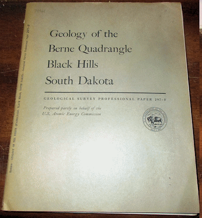
Redden J. A. 1968 GEOLOGY OF THE BERNE QUADRANGLE BLACK HILLS SOUTH DAKOTA USGS Prof. Paper #297-F wraps with some wear, ex-lib., contents vg with 56 pp., 3 plates, 23 figures on the geology of this area of the southern Black Hills. Price: $25.00 (stock#PP297F)

Robinson C. S. 1956 GEOLOGY OF DEVILS TOWER NATIONAL MONUMENT WYOMING U. S. Geological Survey Bulletin #1021-I wps with name stamp else light wear, vg, 14 pp., 1 plate, 4 figs, the plate being the large fold out map in rear pocket Price: $20.00 (stock#USGSB1021I)
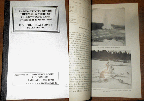
Schlundt H. & Moore R. B. 1909 RADIOACTIVITY OF THE THERMAL WATERS OF YELLOWSTONE NATIONAL PARK U. S. Geological Survey Bulletin #395 8vo, in archival wraps with original publication bound in, contents good with 35 pp., 4 plts, 7 figs. Scarce. Price: $20.00 (stock#USGSB395)

Slichter C. S. and Wolff H. C. 1906 THE UNDERFLOW OF THE SOUTH PLATTE VALLEY USGS Water Supply Paper #184 no wps, ex-lib, cloth tape on spine, vg, 42 pp., figs. Scarce. Price: $15.00 (stock#WSP184)
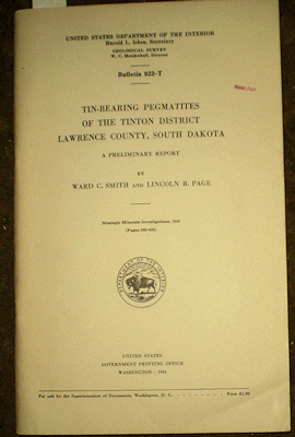
Smith W. C. and Page L. R. 1941 TIN-BEARING PEGMATITES OF THE TINTON DISTRICT LAWRENCE COUNTY SOUTH DAKOTA USGS Bull. 922-T title wps, small stamp, crease to lower outer corner else light wear, vg, 36 pp., 5 plts, 2 figs. Price: $15.00 (stock#USGSB922Tr)
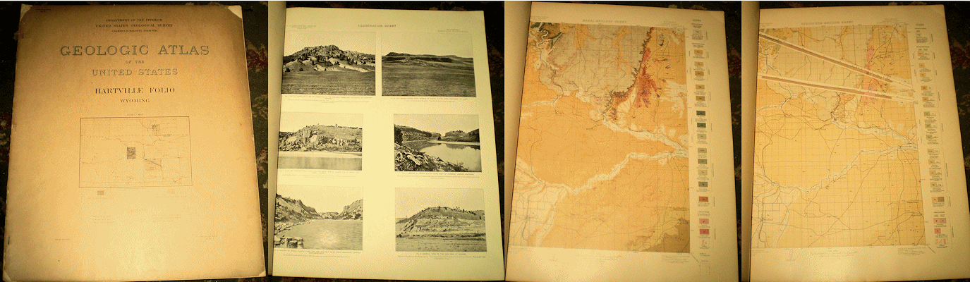
Smith W. S. T. 1903 HARTVILLE FOLIO WYOMING USGS Atlas Folio #90 wraps with some wear, chips/tears, contents vg with 6 pp. Descriptive Text; Topographic Map; Areal Geologic Map; Structural Geology Map; Columnar Section and Illustration Sheets. Price: $35.00 (stock#AF91)
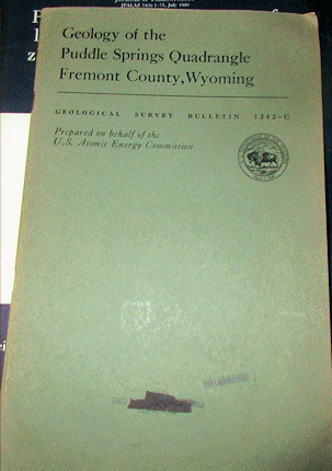
Soister P. E. 1967 GEOLOGY OF THE PUDDLE SPRINGS QUADRANGLE, FREMONT COUNTY, WYOMING U. S. Geological Survey Bulletin #1242-C 8vo, in wraps as issued, ex-lib copy with faded and crossed out stamp to front wrap, some external wear, contents good with 36 pp., 1 plt (map in the rear pocket), 4 figs. The study area is located in the south-central part of the Wind River Basin. Price: $15.00 (stock#USGSB1242C)
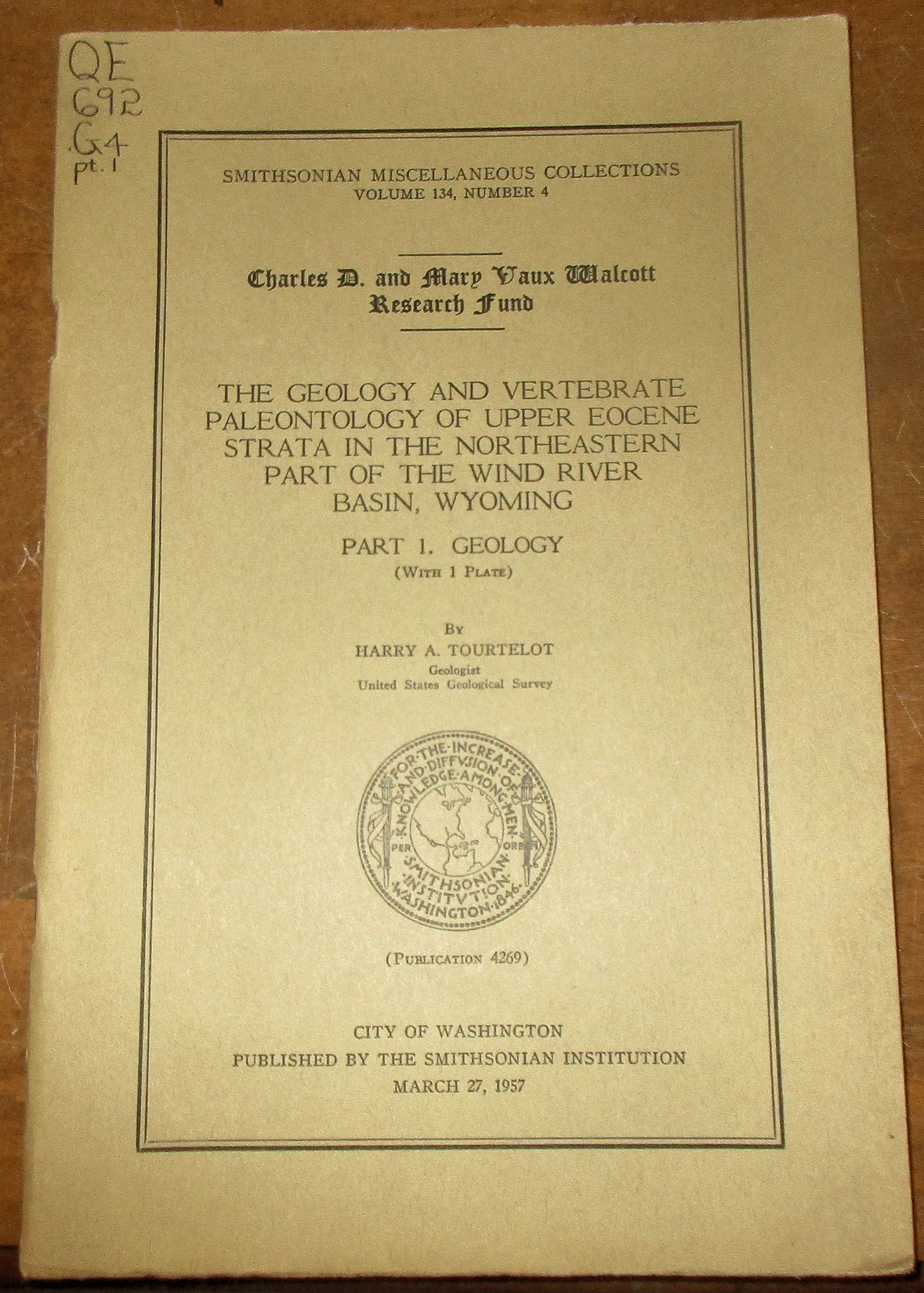
Tourtelot H. A. 1957 THE GEOLOGY AND VERTEBRATE PALEONTOLOGY OF UPPER EOCENE STRATA IN THE NORTH-EASTERN PART OF THE WIND RIVER BASIN, WYOMING, PART 1 - GEOLOGY Smithsonian Misc. Collections #4269, 8vo, in wraps, ex-lib, else contents good with 27 pp., 1 plt, 7 figs. Price: $15.00 (stock#WY61)
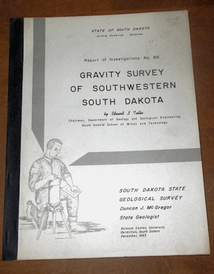
Tullis E. L. 1963 GRAVITY SURVEY OF SOUTHWESTERN SOUTH DAKOTA South Dakota Geological Survey Report of investigations #94 4to, in wraps light wear and a very good copy with 34 pp., 1 plate (folding map in rear pocket), 2 figures and covers the Black Hills and adjacent badlands regions. Price: $20.00 (stock#SDGSRI94)
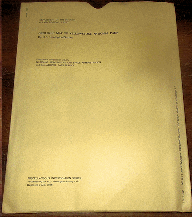
U. S. Geological Survey 1988 GEOLOGIC MAP OF YELLOWSTONE NATIONAL PARK USGS Map I-711 large folding colored map in sleeve, map is very good to fine. Price: $20.00 (stock#I-711)
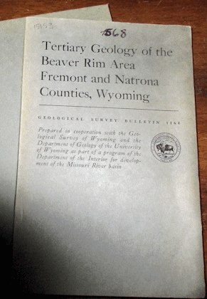
Van Houten F. B. 1964 TERTIARY GEOLOGY OF THE BEAVER RIM AREA FREMONT AND NATRONA COUNTIES WYOMING U. S. Geological Survey Bulletin #1164 text and map slip case, light wear, contents good with 99 pp., 9 plates and additional figures. Price: $20.00 (stock#USGSB1164)
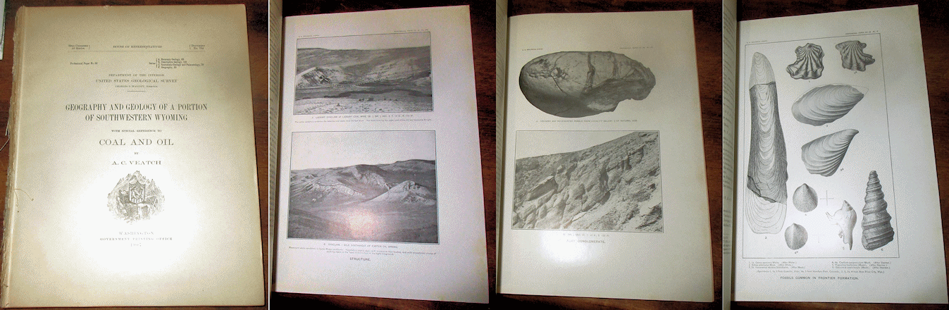
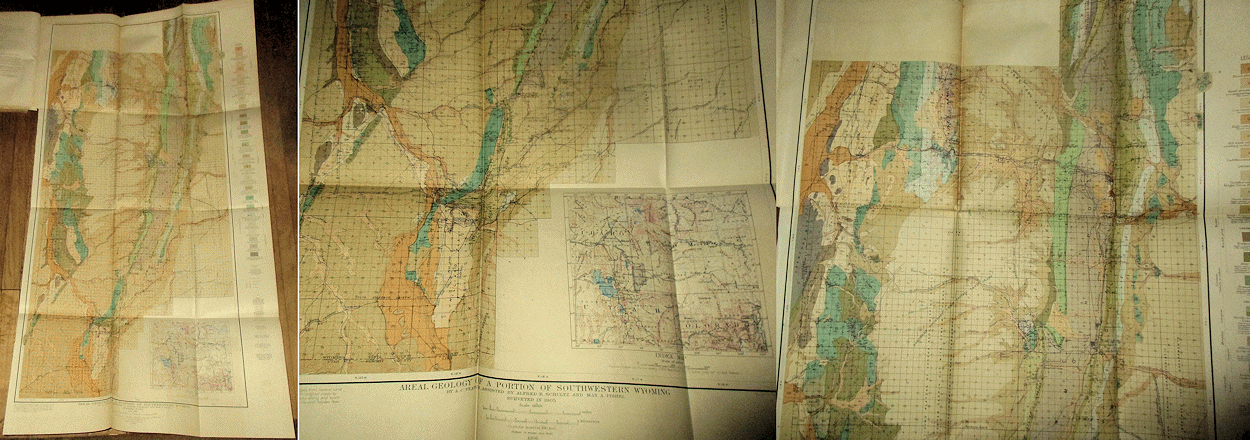
Veatch A. C. 1907 GEOGRAPHY AND GEOLOGY OF A PORTION OF SOUTHWESTERN WYOMING WITH SPECIAL REFERENCE TO COAL AND OIL U. S. Geological Survey Professional Paper #56 4to, no wraps, tape along spine, some wear, overall good copy with 178 pp., 26 plates, 9 figures including the 4 folding maps that detail the geology of southwestern Wyoming. Price: $45.00 (stock#PP56)

Wyant D. G. 1956 RECONNAISSANCE STUDY OF URANIUM DEPOSITS IN THE RED DESERT SWEETWATER COUNTY WYOMING U. S. Geological Survey Bulletin #1030-I 8vo, in wraps as issued, some external wear, faded stamp to wraps, contents good with 71 pp., 8 plates, 3 figures. On the Wasatch, Bridger and Green River Formations of Eocene age in southwestern Wyoming. Price: $20.00 (stock#USGSB1030I)

Wyoming. Four (4) Bedrock Geology Quadrangle maps, all published by the U. S. Geological Survey and consist of the map in printed sleeve, partly faded stamps to sleeves, maps proper with little to light wear and very good. They are (1) GEOLOGIC MAP OF THE CROOKS PEAK QUADRANGLE FREMONT AND SWEETWATER COUNTIES WYOMING (USGS Map GQ-1517); (2) GEOLOGIC MAP OF THE DEER CREEK QUADRANGLE LINCOLN COUNTY WYOMING (USGS Map #1551); (3) GEOLOGIC MAP OF THE PINE CREEK QUADRANGLE LINCOLN AND TETON COUNTIES WYOMING (USGS Map GQ-1549; and (4) GEOLOGIC MAP OF THE GUFFY PEAK QUADRANGLE SHOWING CHROMOLITHOFACIES IN THE WIND RIVER FORMATION, FREMONT AND HOT SPRINGS COUNTIES WYOMING (USGS Map GQ-1527).
Price: $20.00 (stock#WYmapsx4)
OKLAHOMA TEXAS

Amsden T. W. 1960 STRATIGRAPHY AND PALEONTOLOGY OF THE HUNTON GROUP IN THE ARBUCKLE MOUNTAIN REGION PART VI- STRATIGRAPHY wps, ex-lib light+ exterior wear, contents vg, 311 pp., 17 plts, 56 figs. Price: $25.00 (stock#OKB84)

Atlee W. A. 1962 THE LOWER CRETACEOUS PALUXY SAND IN CENTRAL TEXAS Baylor Geological Studies #2 4to, in wraps as issued, some external wear, contents good with 26 pp., 12 figures, locality index and description page at rear. Price: $20.00 (stock#TX07)
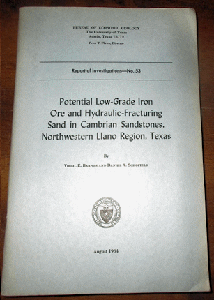
Barnes V. E. and Schofield D. A. 1964 POTENTIAL LOW GRADE IRON ORE AND HYDRAULIC FRACTURING SAND IN CAMBRIAN SANDSTONES NORTHWESTERN LLANO REGION TEXAS Texas Bur. Economic Geology, Rpt. Invest. #53 8vo, wraps, light wear, contents good, 58 pp., 6 plts, 4 figs. Price: $15.00 (stock#UTXRI53)
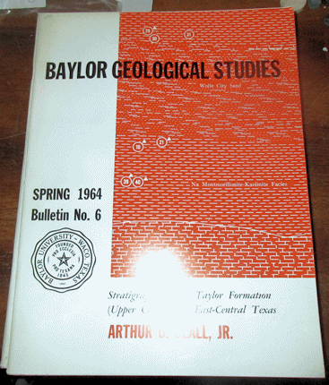
Beall A. O. Jr. 1964 STRATIGRAPHY OF THE TAYLOR FORMATION (UPPER CRETACEOUS), EAST-CENTRAL TEXAS Baylor Geological Studies #6 4to, in wraps as issued, overall light wear, contents good with 34 pp., 12 figures and detailed measured section and locality data. Price: $25.00 (stock#TX08)

CONTRIBUTIONS TO GEOLOGY 1929 Unv. Texas Bull. #2901 8vo, bound in red cloth with gilt titles, ex-dept. library copy else vg, 226 p., 6 pls. Nine papers: (1) DEPOSITIONAL HISTORY OF THE RED BEDS AND SALINE RESIDUES OF THE TEXAS PERMIAN; (2) NOTES ON THE PERMIAN CHINATI SERIES OF WEST TEXAS by Baker C. L.; (3) THE TEXAS METEOR OF JUNE 23, 1928 by Sellards E. H.; (4) THE PALEOZOIC OF THE PEDERNALES RIVER VALLEY IN GILLESPIE AND BLANCO COUNTIES; (5) THE PRATT WELL IN WEBB COUNTY by Jones R. A.; (6) THE PENNSYLVANIAN OSTRACODA FROM MENARD COUNTY, TEXAS by Harlton B. H.; (7) A YEGUA EOCENE DELTA IN BRAZOS COUNTY, TEXAS by Reed and Longnecker Jr.; (8) THE UNIVERSITY DEEP WELL IN REAGAN COUNTY TEXAS by Sellards and Williams; (9) UPPER CRETACEOUS TAYLOR AMMONITES FROM TEXAS by Adkins. Price: $35.00 (stock#UT2901)
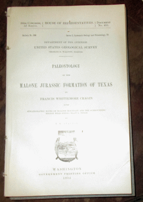
Cragin F. W. and Stanton T. W. 1905 PALEONTOLOGY OF THE JURASSIC MALONE FORMATION OF TEXAS USGS Bull. #266 no wps, binding weak, clean and else a vg copy, 271 pp., 39 plts, of which 38 are of fossils.
Price: $20.00 (stock#USGSB266)
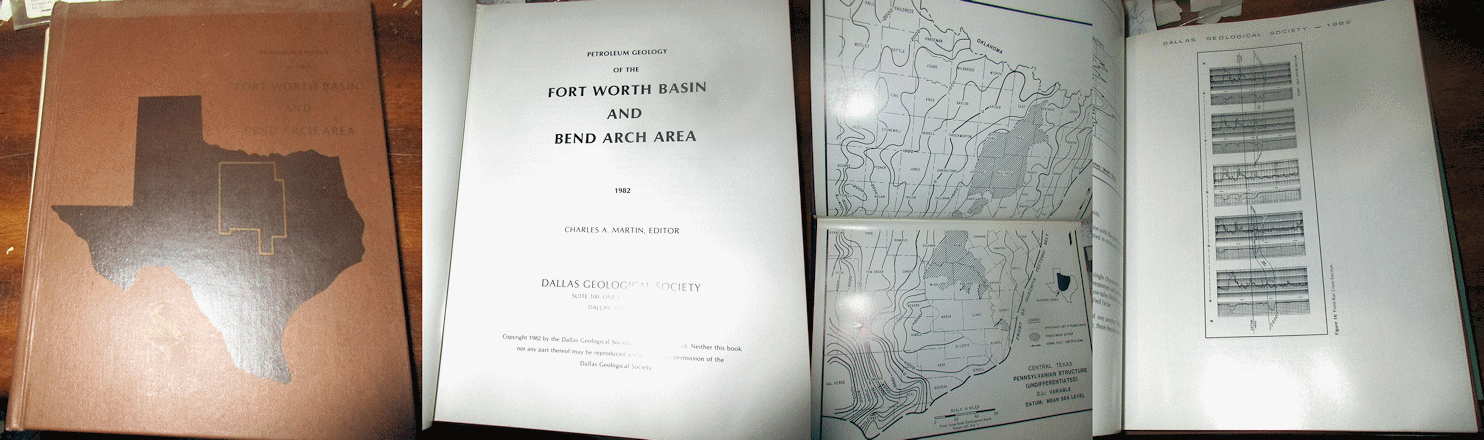
Dallas Geological Society 1982 PETROLEUM GEOLOGY OF THE FORT WORTH BASIN AND BEND ARCH AREA 4to, in cloth as issued, overall light wear, contents very good with 441 pp., scores of figures, microfiche card in rear pocket. Price: 35.00 (stock#TX07)
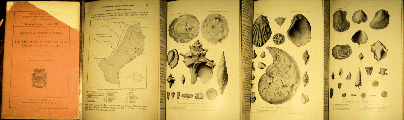
Deussen A. wps with GEOLOGY AND UNDERGROUND WATERS OF THE SOUTHEASTERN PART OF THE TEXAS COASTAL PLAIN USGS Water Supply Paper #335 front wrap with torn upper portion else contents vg, 365 pp., plts including 4 folding maps. Price: $30.00 (stock#WSP335)
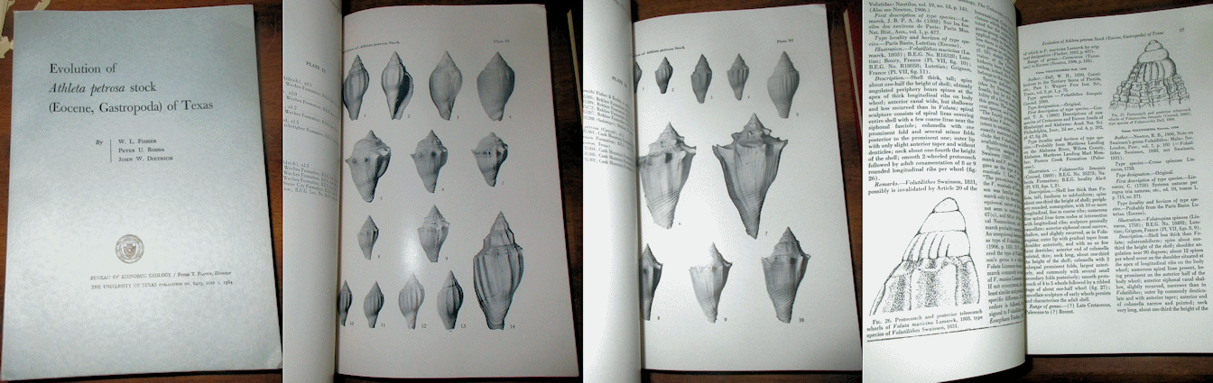
Fisher W. L. et al. 1964 EVOLUTION OF ATHLETA PETROSA STOCK (EOCENE, GASTROPODA) OF TEXAS published by Texas Bureau of Economic Geology, Bulletin #6413 text and maps/plate folder in slip case, light wear, vg copy with 117 pp., 33 figs and 11 plts. Price: $20.00 (stock#UT6413)
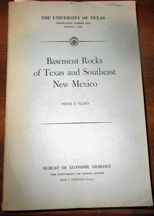
Flawn P. T. 1956 BASEMENT ROCKS OF TEXAS AND SOUTHEAST NEW MEXICO University of Texas Publication #5606 8vo, in wraps, light wear, contents good with 261 pp., 3 plts, 2 figs, 10 photos of thin sections of various basement rocks that underlie Paleozoic or Mesozoic strata across Texas and SE New Mexico. Price: $25.00 (stock#UTX5606)

Freeman V. L. 1969 GEOLOGY OF THE COMSTOCK - INDIAN WELLS AREA VAL VERDE TERRELL AND BREWSTER COUNTIES TEXAS U. S. Geological Survey Professional Paper #594-K 4to, in wraps as issued, light wear, contents very good with 26 pp., 3 plates, 8 figures including fold out maps/charts in pocket. Price: $20.00 (stock#PP594K)
Frezon S. E. 1962 CORRELATION OF PALEOZOIC ROCKS FROM COAL COUNTY OKLAHOMA TO SEBASTIAN COUNTY ARKANSAS Oklahoma Geological Survey Circular #58 8vo, cloth with gilt title and a very good to fine, clean copy with 53 pp., 2 plates (folding pocket map/chart), and 1 figure. Price: $15.00 (stock#OKGSC58)
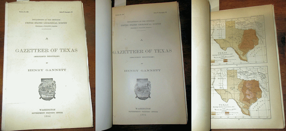
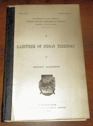
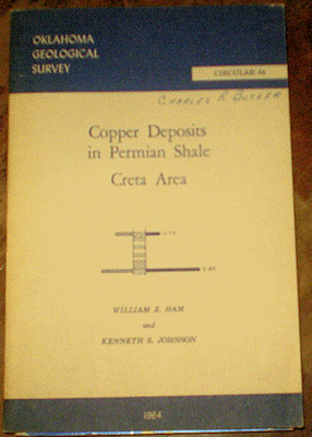
Gannett H. 1904 A GAZETTEER OF TEXAS U. S. Geological Survey Bulletin #224 8vo, in archival wraps else the volume is the original 120 year old text, contents good with 176 pp. 7 plates. Price: $25.00 (stock#USGSB224)
Gannett H. 1905 A GAZETTEER OF INDIAN TERRITORY U. S. Geological Survey Bulletin #248 8vo, no wraps, spine with archival tape, some external wear, contents good with 70 pp. that provide the definitions of all-then place names and major named features within Oklahoma before it attained Statehood. Price: $25.00 (stock#USGSB248)

Gordon C. H. 1911 GEOLOGY AND UNDERGROUND WATERS OF NORTHEASTERN TEXAS U. S. Geological Survey Water Supply Paper #276 8vo, in wraps as issued, some external wear, stamps to front wrap and title page else contents good with 78 pp., 2 plates, 6 figures including the nice, small folding map and much on the Cretaceous Trinity through Tertiary Wilcox Formations which form the region's surface and subsurface bedrock. Price: $25.00 (stock#WSP276)

Ham W. E. 1969 GEOLOGY OF THE ARBUCKLE MOUNTAINS Oklahoma Geological Survey Guidebook #17 4to, in wraps as issued, some wear but overall contents good with 52 pp., 41 figures and folding geological map of Arbuckle Mountais in rear pocket. A classic report with field trip localities & stop descriptions.
Price: $15.00 (stock#OKGB17)
Ham W. E. and Johnson K. S. 1964 COPPER DEPOSITS IN PERMIAN SHALE, CRETA AREA OK Geol. Surv. Circ. #64 wraps with signature else light wear, vg, 32 pp., 2 plates, 10 figs. including fold outs in rear pocket. Price: $15.00 (stock#OKGSCirc64)

Hill R. T. and Vaughn T. W. 1898 THE LOWER CRETACEOUS GRYPHEAS OF THE TEXAS REGION U. S. Geological Survey Bulletin #151 8vo, wraps with some wear, private ownership stamp of the period to title page, some external wear, contents good with 139 pp., 35 plates, 2 figures. A classic treatise on Texas fossils.
Price: $25.00 (stock#USGSB151)
Long A. T. 1963 GROUND-WATER GEOLOGY OF EDWARDS COUNTY TEXAS U. S. Geological Survey Water Supply
Paper #1619-J waps with some wear, light bumps to corners contents vg with 29 pp., 5 plates (folding maps and charts in rear pocket) 2 figures. Price: $15.00 (stock#WSP1619J)
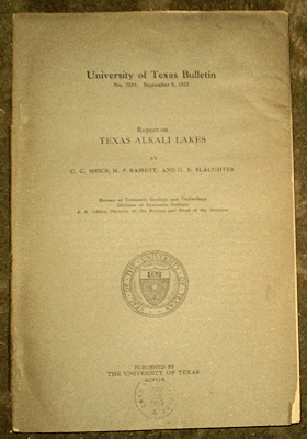
Meigs C. G. et al. 1922 REPORT ON TEXAS ALKAKI LAKES Unv. Texas Bull. #2234 wps loose or wanting to come so, minor chips, small stamp, contents vg, 59 pp., 9 figs. Price: $15.00 (stock#UT2234)
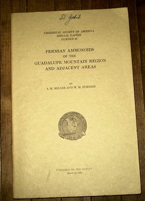
Miller A. K. and Furnish W. M. 1940 PERMIAN AMMONOIDS OF THE GUADALUPE MOUNTAINS REGION AND ADJACENT AREAS GSA Spec. Paper #26 8vo, wps with signature and a few light smudges else vg clean copy of a classic volume on Late Paleozoic ammonoids. With 238 pp., 44 plts, figs. Price: $35.00 (stock#GSASP26)

Munn M. J. 1914 RECONNAISSANCE OF THE GRANDFIELD DISTRICT OKLAHOMA USGS Bulletin #547 archival wps, contents vg, 85 pp., 5 plts including the large folding maps at rear. Price: $25.00 (stock#USGSB547)

Rinehart I. 1957 ARCHER, BAYLOR AND CLAY COUNTIES REFERENCE BOOK published by Rinehart Oil News Company, 4to, wraps with small label across spine, some wear, contents vg, 269 pp. and scores of figures of well logs and location maps. Scarce. Price: $50.00 (stock#TX03)
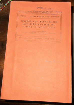
Sayre A. N. 1936 GEOLOGY AND GROUND WATER RESOURCES OF UVALDE AND MEDINA COUNTIES TEXAS U. S.
Geological Survey Water Supply Paper #678 8vo, in wraps as issued, wraps with former owner's name stamp and some external wear, contents good with 146 pp., 11 plates, 2 figures including large folding map bound into text. Price: $15.00 (stock#WSP678)
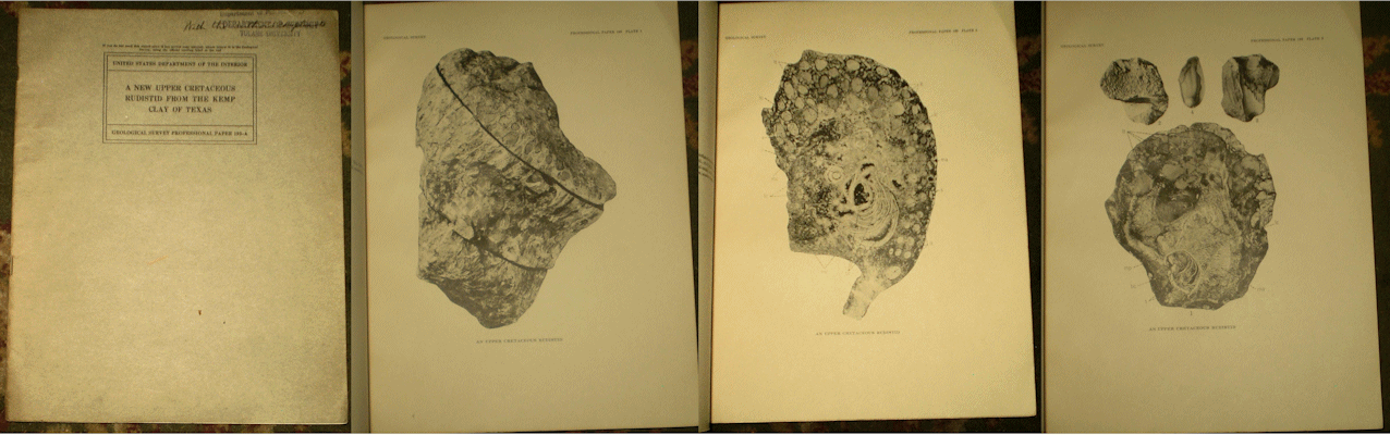
Stephenson L. W. 1938 A NEW UPPER CRETACEOUS RUDISTID FROM THE KEMP CLAY OF TEXAS U. S. Geological Survey Prof. Paper #193-A wps with stamp, notation from the author, some wear contents vg, 15 pp., 5 plts.
Price: $15.00 (stock#PP193A)

Stephenson W. L. 1947 NEW UPPER CRETACEOUS FOSSILS FROM MISSISSIPPI AND TEXAS USGS Prof. Paper #210-E wps with faded stamp, some wear, contents vg, 36 pp., 3 plts. Price: $15.00 (stock#PP210E)

Taff J. A. 1928 PRELIMINARY REPORT ON THE GEOLOGY OF THE ARBUCKLE AND WICHITA MOUNTAINS IN INDIAN TERRITORY AND OKLAHOMA Oklahoma Geological Survey Bulletin #12 8vo, in wraps as issued, some external wear, bumped interior corner, old tape repairs across spine ends, contents very good with 96 pp., 7 plates and 1 figure. Price: $25.00 (stock#OKB12)
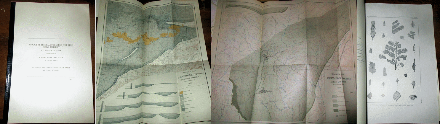
Taff, J. A et al. 1899 GEOLOGY OF THE MCALESTER-LEHIGH COAL FIELD, INDIAN TERRITORY from 19th Annual Report of the U. S. Geological Survey, 4to, spine with archival tape else light wear, very good and clean copy with 177 pp., 9 plates, 4 figures including the two large folding colored geologic maps, some of the plates being of fossils from the region. Price: $25.00 (stock#OK22)
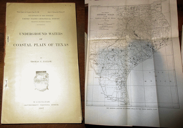
Taylor T. U. 1907 UNDERGROUND WATERS OF THE COASTAL PLAIN OF TEXAS U. S. Geological Survey Water Supply Paper #190 8vo, no wraps, some external wear, contents good with 73 pp., 3 plts. Price: $20.00 (stock#WPS190)

Texas, Palo Duro Basin. Two (2) reports from private industry contractors on Oil, Gas, Petroleum geology and structure of the Texas Panhandle. They are: (1) Rose P. R. 1986 HYDROCARBON RESOURCES OF THE PALEO DURO BASIN TEXAS PANHANDLE 4to, in wraps light wear, very good copy with 100 pp., folding and pocket maps, figures; and (2) Rose P. R. 1986 PETROLEUM GEOLOGY OF THE PALEO DURO BASIN TEXAS PANHANDLE 4to, in wraps light wear, very good copy with 100 pp., folding and pocket maps, figures. A nice set of oil industry reports on a profilic and historical area for exploration and drilling, and hard to find. Price: $25.00 (stock#TX04)

Tomilson C. W. 1929 THE PENNSYLVANIAN SYSTEM IN THE ARDMORE BASIN OK Geol. Surv. Bull. #46 wps with signature else vg, 70 pp., 20 plts, 3 figs. Price: $25.00 (stock#OKB46)
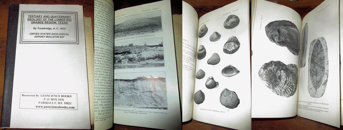
Trowbridge A. C. 1932 TERTIARY AND QUATERNARY GEOLOGY OF THE LOWER RIO GRANDE REGION TEXAS U. S. Geological Survey Bulletin #837 8vo, original volume in archival wraps, contents good with 260 pp., 45 plates, 76 figures. Many of the plates are of fossils from the region, with large folding maps and charts in the rear pocket. Scarce.
Price: $30.00 (stock#USGSB837)

Vaughn T. W. 1900 RECONNAISSANCE IN THE RIO GRANDE COAL FIELDS OF TEXAS U. S. Geological Survey Bulletin #164 8vo, in archival wraps with original bulletin inside, light wear, contents good, 100 pp., 11 plts, 9 figs. On Cretaceous marginal marine strata of the Rio Grande Valley region of south Texas. Scarce. Price: $25.00 (stock#USGSB164)

Vaughn T. W. 1900 UVALDE TEXAS USGS Atlas Folio #64 wps with light wear minor chips, ex-lib else contents vg with 7 pp. Descriptive Text; Topographic Map; Historical Geologic [bedrock] Map; Structural Geology. Price: $30.00 (stock#AF64)
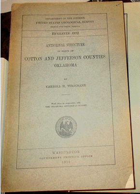
Wegemann C. H. 1915 USGS Bull. #602 ANTICLINAL STRUCTURE IN PARTS OF COTTON AND JEFFERSON COUNTIES OKLAHOMA U. S. Geological Survey Bulletin #602 wraps with corner tear else light wear, a very good copy with 108 pp., 9 plates including pocket map. Price: $20.00 (stock#USGSB602)
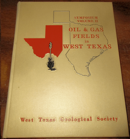
West Texas Geological Society 1969 OIL AND GAS FIELDS IN WEST TEXAS Symposium Volume II 4to, in decorated cloth as issued, some external wear, contents good with 128 pp., scores of figures, many being maps and well logs. Note this not volume 2 of a set of books, but rather vol. 2 in a series of Symposium papers and reports published by the West Texas Geological Society, intended to supplement the first vol., published in 1966. Hence it is a stand alone work.
Price: $30.00 (stock#TX04)

White D. 1937 FOSSIL FLORA OF THE WEDINGTON SANDSTONE MEMBER OF THE FAYETTEVILLE SHALE U. S. Geological Survey Professional Paper #186-B 4to, title wraps as issued, ex-MIT library copy, some external wear, contents good with 28 pp., 6 plates. Price: $20.00 (stock#PP186B)
White D. et al. (eds) STRUCTURE AND OIL AND GAS RESOURCES OF THE OSAGE RESERVATION OKLAHOMA USGS Bull. #686, text and map packet, wps and page fore edges with small stain but does not effect contents, tears to paper spine cover, contents proper are vg, all maps are present in the separate map folder that is seldom found with the volume. Very scarce. With 425 pp., 60 plts, 52 figs. Price: $80.00 (stock#USGSB686)
TENNESSEE KENTUCKY WEST VIRGINIA

Bridge J. and Rodgers J. 1956 STRATIGRAPHY OF THE MASCOT JEFFERSON CITY ZINC DISTRICT TENNESSEE USGS Prof. Paper #277 wps ex-lib else vg with 76 pp., 3 plts 2 figs. Price: $25.00 (stock#USGSPP277)

Campbell M. R. 1898 RICHMOND FOLIO KENTUCKY USGS Atlas Folio #46 wraps with marginal chips, some wear, contents vg with 7 pp. Descriptive Text, Topographic Map, Areal Geologic Map, Economic Geology Map, Structural Geology Map. Price: $30.00 (stock#AF46)
Campbell M. R. and Mendenhall W. C. 1896 GEOLOGIC SECTION ALONG THE NEW AND KANAWHA RIVERS IN WEST VIRGINIA from 17th USGS Annual Report, 4to, spine with archival tape, contents vg with 40 pp., 12 plates including the large colored fold out pocket section/map. Price: $20.00 (stock#WV21)
Cross A. T. and Schemel M. P. 1956 GEOLOGY AND ECONOMIC RESOURCES OF THE OHIO RIVER VALLEY IN WEST VIRGINIA West Virginia Geological Survey Volume 22 4to, in cloth as issued, overall light wear, contents clean with approx. 500 pp. (each of the three chapters are individually paginated), scores of figures and covers the region in three parts which are: GEOLOGY; ECONOMIC RESOURCES; and GROUND-WATER RESOURCES. A classic on the geology, natural resources and their economic potential of the Ohio Valley in West Virginia. Price: $40.00 (stock#WV08)
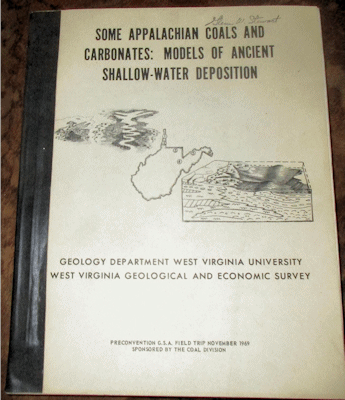
Donaldson A. C. (ed.) 1969 SOME APPALACHIAN COALS AND CARBONATES: MODELS OF ANCIENT SHALLOW WATER DEPOSITION WV Geological Survey and Geological Society of America Guidebook, in wraps with cloth tape along spine, name stamp, some external wear, contents very good with 384 pp., scores of figures that cover a variety of depositional settings from shallow marine to lacustrine, and with good locality data. Scarce. Price: $30.00 (stock#WV14)

Gannett, H. 1904 A GAZETTEER OF WEST VIRGINIA U. S. Geological Survey Bulletin #233 8vo, in wraps as issued, former ownership stamps to wraps else light wear, and a very good copy with 164 pp. covering the place and geographic names of West Virgina Scarce. Price: $20.00 (stock#USGSB233)
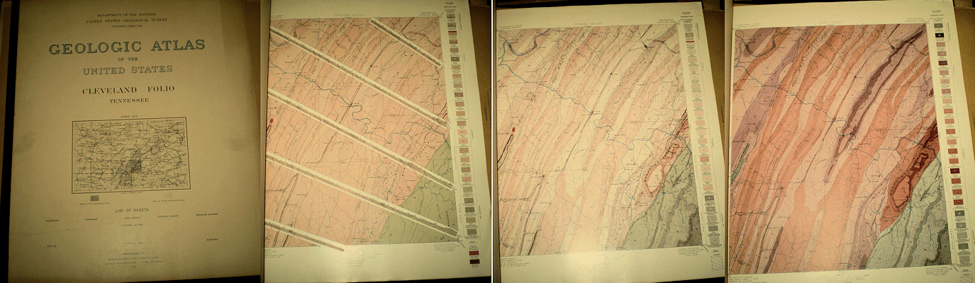
Hayes C. W. 1895 CLEVELAND FOLIO TENNESSEE USGS Atlas Folio #19 wraps with light dust soiling else overall light wear, contents clean and very good with 4 pp. Descriptive Text; Topographic Map, Areal Geologic Map; Economic Geology Map, Structural Geology Map, Columnar Section Sheet. Price: $30.00 (stock#AF19)
Hayes C. W. 1896 THE TENNESSEE PHOSPHATES from USGS 17th Annual Report, 4to, tape along spine, vg clean copy with 30 pp., 6 plates and 1 figure. Price: $20.00 (stock#TN07)

Holmes A. E. (ed.) 2015 DIVERSE EXCURSIONS IN THE SOUTHEAST: PALEOZOIC TO PRESENT Geol. Soc. America Field Guide 39. wraps light wear, vg, 266 pp., scores of figs and focused on field trip stops and descriptions around the eastern half of Tennessee and adjacent States. Price: $25.00 (stock#TN11)

Jillson W. R. 1928 GEOLOGY AND MINERAL RESOURCES OF KENTUCKY Kentucky Geological Survey, 6th Series Bulletin #17 8vo, blue cloth as issued, cloth with crease, some external wear, contents good with frontis plate of the Ohio River, 304 pp., 115 figs. A classic volume on Kentucky geology. Price: $30.00 (stock#KY6thB17)

McCue J. B. et al. 1948 CLAYS OF WEST VIRGINIA West Virginia Geological Survey Volume 18 8 vo, in cloth as issued, overall light wear, vg copy, 234 pp., 9 plts, numerous figs and a sought after volume by those interested in ceramic, brick manufacture and other applications and uses of mineral clays. Price: $35.00 (stock#WVGSvol18)

MacFarlan A. C. 1950 GEOLOGY OF KENTUCKY published by Unv. of KY 8vo, in cloth as issued, overall light wear, ownership inscription inside front cover else a good copy of this work with 531 pp., 117 plates, 42 figures on the geology of Kentucky. Price: $45.00 (stock#KY07)

Miser H. D. 1921 MINERAL RESOURCES OF THE WAYNESBORO QUADRANGLE TENNESSEE Tennessee Geological Survey Bulletin #26 in wraps as issued, light wear, contents very good with 171 pp., 16 plates, 7 figures including the folding map in rear pocket, on the geology and paleontology of this area of south-central Tennessee.
Price: $25.00 (stock#TNGSB26)

Morse W. C. and Foerste A. F. 1912 THE WAVERLAIN FORMATIONS OF EAST CENTRAL KENTUCKY AND THEIR ECONOMIC VALUES Kentucky Geological Survey, 3rd Series, Bulletin #16, 8vo, in brown pebbled cloth as issued, light wear, contents vg with 76 pp., 5 figs on the Devonian to Mississippian age strata of Kentucky.
Price: $25.00 (stock#KY3rdB16)
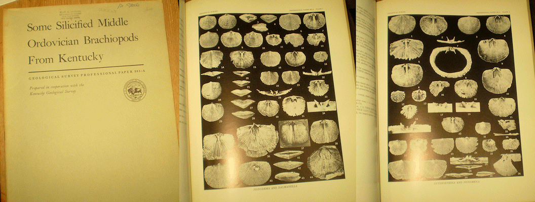
Neuman R. B. 1967 SOME SILICIFIED MIDDLE ORDOVICIAN BRACHIOPODS FROM KENTUCKY USGS Prof. Paper #583-A 4to, wps, ex-lib else light wear, vg, 14 pp., 2 plts, 4 figs. Price: $10.00 (stock#PP583A)
OWEN D. D. 1857 SECOND REPORT OF THE GEOLOGICAL SURVEY OF KENTUCKY MADE DURING THE YEARS 1856 AND 1857 4to, orig. cloth, spine mostly chipped away, exterior wear with board edges rubbed through, contents clean and vg, 391 pp. Price: $75.00 (stock#KYOwen2ndc2)
OWEN D. D. 1857 THIRD REPORT OF THE GEOLOGICAL SURVEY OF KENTUCKY MADE DURING THE YEARS 1856 AND 1857 4to, orig. cloth, spine with chips, loose or coming so, exterior wear, contents clean, vg, 589 pp., plts, figs.
Price: $75.00 (stock#KYOwen3rdc1)

Owen D. D. 1861 KENTUCKY GEOLOGICAL SURVEY VOLUME 4 cloth as issued, chips to spine ends, corners rubbed through, scattered foxing but contents generally clean, vg, 617 pp., several figures, folding chart. Scarce. Price: $75.00 (stock#KYGSOwen4)

Phalen W. C. 1908 ECONOMIC GEOLOGY OF THE KENOVA QUADRANGLE KENTUCKY OHIO AND WEST VIRGINIA USGS Bull. #349 wraps loose, some wear, contents vg, 158 pp., 6 plts 21 figs. Price: $20.00 (stock#USGSB349)
VOLUME C. Proctor J. R. 1884 EASTERN COAL FIELD royal 8vo, orig. cloth, light exterior wear, ex-lib. with period stamps and book plate of the Franklin Institute vg copy, 305 pp. + plts. Price: $40.00 (stock#KYVolC)

Ross R. J. 1967 CALYMENID AND OTHER ORDOVICIAN TRILOBITES FROMN KENTUCKY AND OHIO USGS Prof. Paper #583-B 4to, wps, ex-lib, vg, 19 pp., 5 plts of fossils, 3 figs. Price: $20.00 (stock#PP583B)

Smith R. W. and Whitlatch G. L. 1940 THE PHOSPHATE DEPOSITS OF TENNESSEE Tennessee Division of Geology Bulletin #48 8vo, in wraps as issued, some external wear, contents good with 444 pp., 14 plates, and 7 figures including the large folding maps and charts in the front and rear pockets. With much on the Ordovician limestones and some comment on fossils of central Tennessee. Price: $25.00 (stock#TNGSB48)

Stose G. W. and Schrader F. C. 1923 MANGANESE DEPOSITS OF EAST TENNESSEE U. S. Geological Survey Bulletin #737 8vo, in wraps as issued, some external wear, stamps to front wrap, contents good with 154 pp., 30 plates, 45 figures. One of the classic references on eastern Tennessee geology, and complete with large, folding colored map. Price: $25.00 (stock#USGSB737)

Thurston W. R. and Hardin G. C. Jr. 1954 FLUORSPAR DEPOSITS IN WESTERN KENTUCKY PART 3: MOORE HILL FAULT SYSTEM, CRITTENDEN AND LIVINGSTON COUNTIES; and Klepser H. J. 1954 FLUORSPAR DEPOSITS IN WESTERN KENTUCKY, PART 3: SENATOR-SCHWENCK AREA, TABB FAULT SYSTEM, CALDWELL COUNTY USGS Bull. #1012-E-F, wraps, some wear, contents vg, 46 pp., 8 plates (pocket maps), 1 fig. Price: $15.00 (stock#USGSB1012EF)
Ulrich E. O. and Tangier W. S. 1905 THE LEAD ZINC AND FLUORSPAR DEPOSITS OF WESTERN KENTUCKY U. S. Geological Survey Professional Paper #36 4to, bound in buckrum with original front wrap retained, front wrap with some wear and marginal chips, contents of volume with no ownership markings and overall are very good. With 218 pp 15 plates 30 figures. Price: $50.00 (stock#PP36)

Wilson C. W. Jr. 1948 (1991 2nd edition), THE GEOLOGY OF NASHVILLE TENNESSEE Tennessee Geological Survey Bulletin #53 in wraps as issued, light wear, contents very good with 172 pp., 29 plates, mostly of fossils. A nice reference for the region with good locality data and measured sections of outcrops. Price: $25.00 (stock#TNGSB53)
Wilson C. W. Jr. 1949 PRE-CHATTANOOGA STRATIGRAPHY IN CENTRAL TENNESSEE Tennessee Division of Geology Bulletin #56 (2nd edition, 1990) 8vo, in wraps as issued, light wear, contents very good with 415 pp., 28 plates, 89 figures and on the Pre-late Devonian strata and fossils of central Tennessee.
Price: $20.00 (stock#TNGSB56)

Woodward H. P. 1949 CAMBRIAN SYSTEM OF WEST VIRGINIA West Virginia Geological Survey, Volume 20, 8vo gilt cloth vg copy with 317 pp. 52 plates, 10 figures. Price: $30.00 (stock#WGSV20)

Woodward H. P. 1951 ORDOVICIAN SYSTEM OF WEST VIRGINIA West Virginia Geological Survey, Volume 21 8vo gilt cloth vg copy with 627 pp. 38 plates 43 figures. Price: $35.00 (stock#WVGSV21)